


Tuesday, February 13, 2018 – Weather forecast update at 4pm:

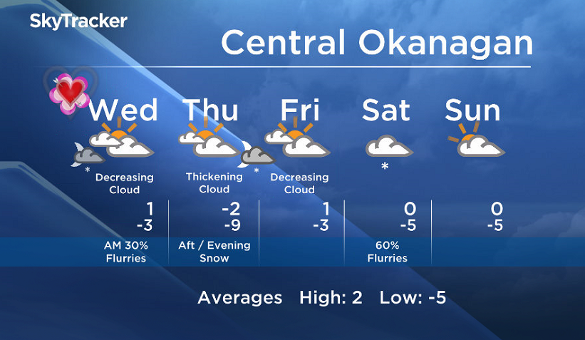
We will see bands of clouds and flurries with sunny breaks in between over the next several days.
Snow amounts will vary as some areas near the border will see little or no accumulation, while parts of the Columbia will see at least 10cm.

Get daily National news
Get daily Canada news delivered to your inbox so you'll never miss the day's top stories.
By providing your email address, you have read and agree to Global News' Terms and Conditions and Privacy Policy.
After snow Tuesday night for most areas, we will see a brief drier spell Wednesday and Thursday morning, before another wave of snow pushes in Thursday night.
- Record slow hurricane season, but Maritimers warned to stay vigilant about extreme weather
- Tornado confirmed in Winnipeg neighbourhood, another west of the city
- ‘A lot of work ahead’: Storm-ravaged Saskatchewan cities continue cleanup
- ‘Warzone’: Storm rips through Winnipeg leaves thousands without power


Wednesday’s daytime high range: -2 to +3C
We will have the rest of your weather details coming up at 5, 6:30 and 11pm – Hope you can join us!
~ Duane/Wesla


Comments
Want to discuss? Please read our Commenting Policy first.