

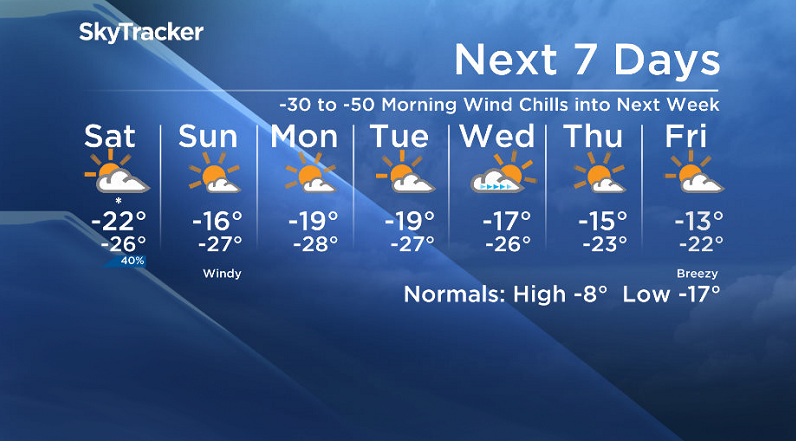
-30 to -50 morning wind chills continue into next week.

Saskatoon Forecast
Friday
Light snow and clouds helped us have a fairly mild start to our first Friday of February with temperatures only dipping back to -22 degrees with wind chills down as cool as -33.
A few breaks of sunshine were spotted midday before cloud cover and pockets of light snow continued into the afternoon with a daytime high around -20.
Friday Night

Get daily National news
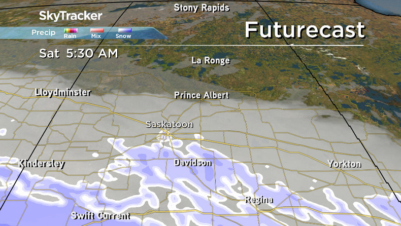
Light snow will continue Friday night with a few centimetres possible as waves of Pacific moisture spread across the region and we cool back into the mid -20s with wind chills in the mid -30s.
Saturday
A bit of light snow is likely to linger to start off the weekend early Saturday before easing midday as clouds clear out in the afternoon bringing in some late day sunshine.
The skies are being carved out by an arctic high that’ll keep conditions cool, feeling like the mid -30s in the morning before temperatures climb to around -22 by afternoon with wind chills stuck in the -30s all day.

Sunday
Sunshine with just a few clouds will stick around for Sunday, but westerly winds will kick in up to 30 km/h with gusts in excess of 50 km/h possible, helping mild down some milder air during the day.
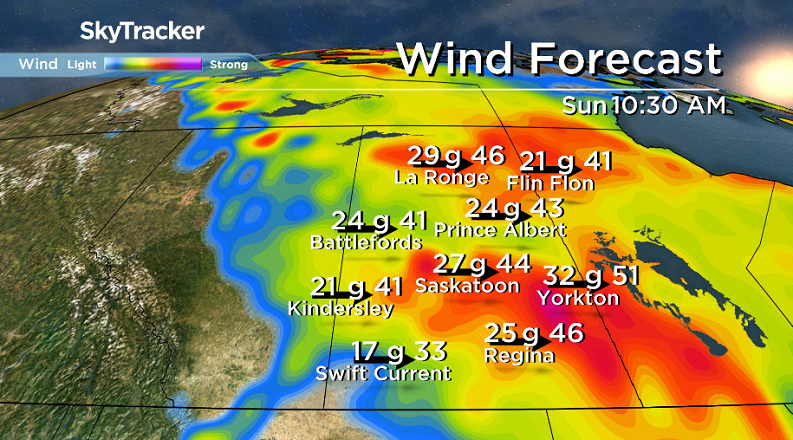


Wind chills will reach close to extreme cold warning criteria of -40 in the morning before the mercury pops up all the way into the minus teens for an afternoon high.

Work Week Outlook
Another arctic high will help push the cold air back down on us again early next week with extreme cold morning wind chills possible as daytime highs attempt to make it back into the minus teens with lots of sunshine.
A few more clouds may move in mid-week with a gradual warm-up expected as we finally tap into some slightly milder air that should boost us safely into the mid-minus teens at least later in the week.
Sandy Bay was the setting for Scott MacPhee to take the Your Saskatchewan photo for Feb. 2.

Saskatoon weather outlook is your source for Saskatoon’s most accurate forecast and is your one stop shop for all things weather for central and northern Saskatchewan with comprehensive, in depth analysis that you can only find here.
Comments
Want to discuss? Please read our Commenting Policy first.