
Thursday, January 18, 2018 – Weather forecast update at 4pm:

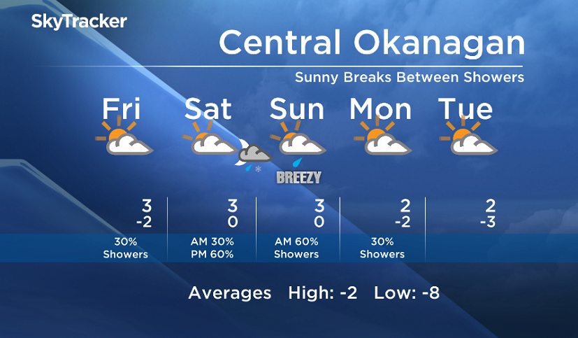
Sunny breaks between showers will continue until Saturday morning, with more clouds for areas near the mountains.
The shower potential will increase this weekend when a stronger push will move inland from the Pacific Saturday evening. Mixed precipitation is possible Saturday night.

Get daily National news
Get daily Canada news delivered to your inbox so you'll never miss the day's top stories.
By providing your email address, you have read and agree to Global News' Terms and Conditions and Privacy Policy.
Daytime freezing levels will remain above the valley base, keeping daytime high temperatures near or above freezing.


Friday’s daytime high range: 1 to 5C
We will have the rest of your weather details coming up at 5, 6:30 and 11pm – Hope you can join us!
~ Duane/Wesla
Comments
Want to discuss? Please read our Commenting Policy first.