

Aerial photos emerging from the California wildfires show homes completely levelled by the infernos and green spaces charred.

READ MORE: Wine country fires could mean fewer California wines for years
About 800 firefighters struggled to contain the blazes on Friday, which have killed an unprecedented 31 people and destroyed at least 35,000 homes and businesses. An estimated 25,000 people have been forced to flee, with new evacuations still being issued.
WATCH: More coverage of the California wildfires

-
![]() California’s worst ever wildfires expected to intensify
California’s worst ever wildfires expected to intensify -
![]() Santa Rosa neighbourhood levelled by northern California wildfire
Santa Rosa neighbourhood levelled by northern California wildfire -
![]() Former Oiler Grant Fuhr and wife forced to flee California wildfires
Former Oiler Grant Fuhr and wife forced to flee California wildfires -
![]() Fierce winds spread deadly, out of control fires in California
Fierce winds spread deadly, out of control fires in California -
![]() Wildfires spread throughout northern California, hundreds reported missing
Wildfires spread throughout northern California, hundreds reported missing -
![]() Commuters facing smoke-clogged drive in Orange County, California
Commuters facing smoke-clogged drive in Orange County, California -
![]() More evacuations ordered as California wildfires grow
More evacuations ordered as California wildfires grow -
![]() Drone video captures devastation left behind by California wildfires
Drone video captures devastation left behind by California wildfires -
![]() Dash cam video shows California police driving down street engulfed in flames
Dash cam video shows California police driving down street engulfed in flames


Wildfires which began Sunday have left hundreds more missing or injured, authorities said on Friday.
They explained that the real recovery efforts will begin once firefighters are able to contain the 21 wildfires, which are covering more than 300 square kilometres. Most are less than 10 per cent contained.
READ MORE: Fire officials warn even a discarded cigarette will ignite a blaze
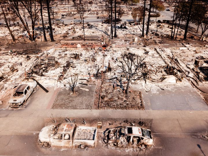
Here are some aerial shots that show the extent of the damage in the city of Santa Rosa, which is among the worst hit by the fires.

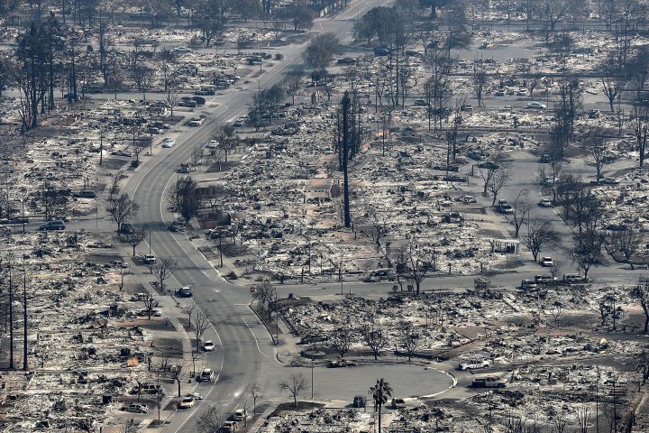
Here are photos of the neighbourhood surrounding Coffey Park in Santa Rosa, taken on Wednesday:
READ MORE: What are the ‘Diablo winds’ fanning the flames in wine country?


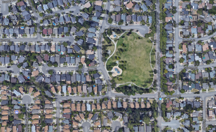
Here’s what the neighbourhood looked like before the fire.
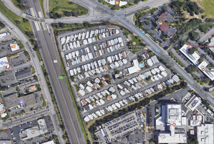
The city’s Journey’s End mobile home park was completely levelled by the fire.

This is what it looked like just days ago:
According to ABC News, dozens of rescue personnel are currently searching the mobile home park for bodies and injured people.

Get daily National news
Sonoma County Sheriff’s Sgt. Dave Thompson said they discovered one body Friday, and there is a “high probability” there will be more.
— With files from the Associated Press, Reuters


Comments