

Blistering heat subsides slightly, but it will be back!

Heat Warning
A heat warning remains in effect for Melfort, Pelican Narrows, Hudson Bay and southern Saskatchewan.
A period with maximum daily temperatures reaching near 29 C or above and minimum overnight temperatures near 14 C or above is expected to continue into this weekend.
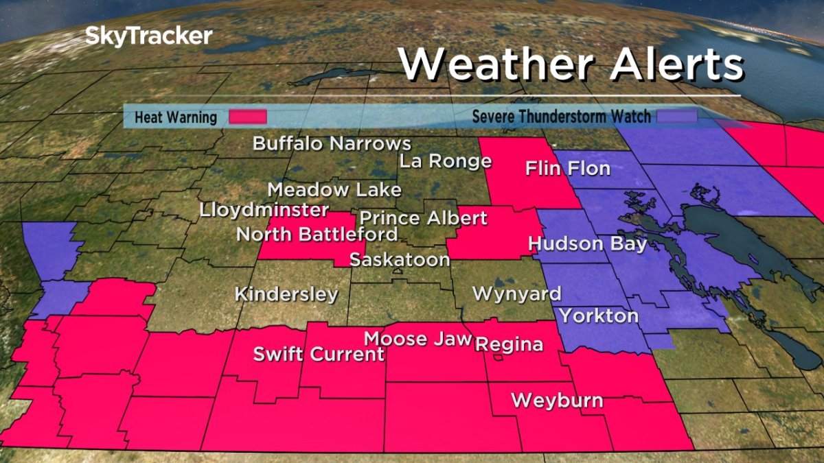
The agency says to watch for the effects of heat illness, including swelling, rash, cramps, fainting, heat exhaustion, heat stroke and the worsening of some health conditions.
For the latest weather alerts download the Global News Skytracker weather app for iPhone, iPad or Android.
Saskatoon Forecast
Friday
Showers and thunderstorms started the day in Saskatoon as a cold front swept through and temperatures fell back to 17 degrees.
Clouds quickly cleared and we sat in the sun for the rest of the morning as we warmed up to humidex values in the 30s before noon.
Sunny skies will stick around for the rest of the day as we climb up to an afternoon high around 30 degrees, which will feel like the mid 30s with humidity.
Friday Night
Clear skies will start the evening before some clouds build in overnight as we cool back into the low teens.
Saturday
A pulse of moisture will keep us under mostly cloudy skies with a chance of showers for the first half of the day before skies clear out later in the day and we return to some sun.

Temperatures should climb into the upper 20s for an afternoon high with humidex values making it feel like the low 30s.

Sunday
Beautiful blue skies and sunshine will be back in full force for Sunday with some clouds building in late in the day and a chance of showers and thunderstorms into the evening as a low pressure system and coupled cold front slide through.


Hot weather will also make its return as an upper ridge builds back in heat soaring a few degrees into the 30s during the day, which could feel as warm as 37 with humidity.


Work Week Outlook
Mostly sunny skies should dominate the start of the work week with daytime highs slightly cooler, in the upper 20s, before soaring up into the low 30s once again for the middle to end of the week as an upper ridge returns.

Alie Neish took this Your Saskatchewan photo near Naicam:

Saskatoon weather outlook is your source for Saskatoon’s most accurate forecast and is your one stop shop for all things weather for central and northern Saskatchewan with comprehensive, in depth analysis that you can only find here.
- Small grocers, co-ops receiving boost from Loblaw boycott: ‘A lot of anger’
- B.C. man losing vision needs to find home for treasured book collection
- U.K. bans generic passwords over cybersecurity concerns. Should Canada be next?
- More foreign interference action coming after inquiry report, India arrests: LeBlanc
Comments