

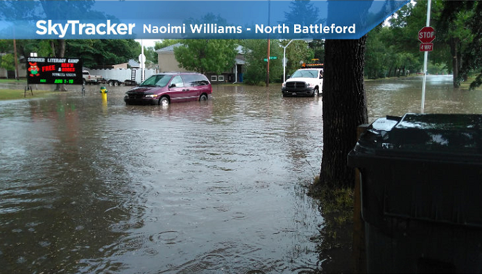
Well in excess of a one-in-100 year rain event in Buffalo Narrows, drought-like conditions in Saskatoon.

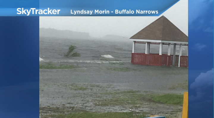
Buffalo Narrows Flooding
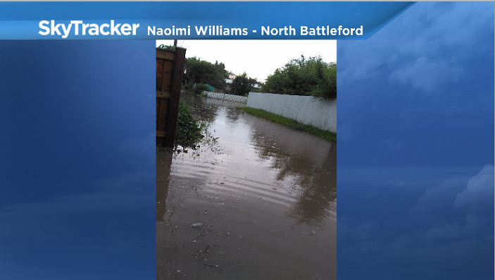
Parts of Buffalo Narrows are underwater after heavy rain hit the area Monday.
112.3 millimetres of rain fell in less than 24 hours, leaving streets drenched, water levels rising to homes and Buffalo Narrows Park swamped.
The Saskatchewan Water Security Agency (WSA) is calling this “well in excess of a one-in-100-year event” due to the fact that much of the rain fell over a 12 hour period.
This region has experienced record wet conditions since mid-April and the Churchill River was already hold at or near peak levels, near one-in-50 year levels prior to this rainfall event at Patuanak.
Areas upstream of Patuanak are expected to see the most significant increases in flows and potential for flood damages from this event.
The WSA is advising people to use caution around waterways as the deep, fast moving water poses a serious hazard and to take steps to protect property.
Meantime, southern Saskatchewan is dealing with a moderate to severe drought.
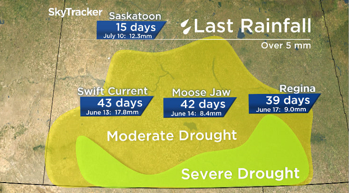
Swift Current, Moose Jaw and Regina have not seen any significant rain over 5 millimetres in over 1 month.

Get breaking National news
Despite a few heavy rainfalls in summer storms, the Saskatoon airport has only recorded 21.2 millimetres of rain in July, which is around a third of our normal 60.3 millimetres seen on average.
READ MORE: ‘1-in-25 year storm’ slams Saskatoon with flooding
Heat Warning
Environment Canada has issued a heat warning for the North Battleford, Lloydminster, Meadow Lake, La Loche and Buffalo Narrows areas.
A period with maximum daily temperatures near 29C or above, and overnight low temperatures near 14C or above, is expected to begin Wednesday.
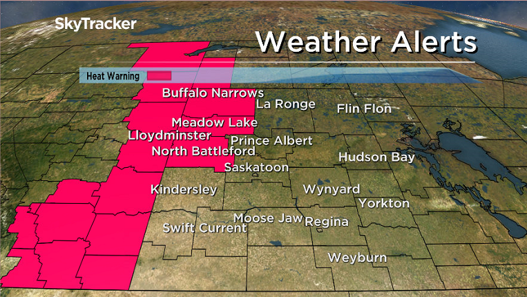
The warm temperatures are expected to last for a few days.
The agency says to watch for the effects of heat illness, including swelling, rash, cramps, fainting, heat exhaustion, heat stroke and the worsening of some health conditions.
For the latest weather alerts download the Global News Skytracker weather app for iPhone, iPad or Android.
Saskatoon Forecast
Tuesday
After a bit of rain and drizzle overnight and mostly cloudy skies to start the day, temperatures in Saskatoon rose up from a morning low of 14 degrees into the 20s before noon.
Winds remained fairly strong through the day behind the system that brought rain to the north with sustained speeds of 30 to 40 km/h and gusts around 50 km/h.


Later in the day more sunshine moved in as temperatures climbed up into the mid 20s for an afternoon high.
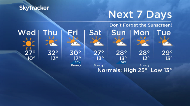
Wednesday
High pressure passing by will keep us in the sunshine on Wednesday and also help winds to ease right back.
Under beautiful blue skies and sunshine, temperatures will climb up to an afternoon high around 27 degrees or so later in the day.
Thursday-Friday
Mostly sunny skies will stick around under an upper ridge on Thursday before we may get a few more clouds with a slight chance of thunderstorms as a system slides by on Friday.
Daytime highs look like they’ll be pushing up into the low 30s both days with a high UV index, so be sure to slap on some sunscreen before heading out!
Weekend Outlook
There remains a bit of discrepancy in the weekend forecast, but at this point it looks like both days should hold a mix of sun and cloud with a slight chance of showers and daytime highs in the upper 20s.
This Your Saskatchewan photo of a hay bale that was struck by lightning near Dundurn was taken by Tanner Anderson:

Saskatoon weather outlook is your source for Saskatoon’s most accurate forecast and is your one stop shop for all things weather for central and northern Saskatchewan with comprehensive, in depth analysis that you can only find here.
- ‘Alarming trend’ of more international students claiming asylum: minister
- Justin Trudeau headed to UN Summit of the Future amid international instability
- Canadian government’s satellite deal has Tories calling for Elon Musk involvement
- Activists call for Boogie the monkey to be removed from Ontario roadside zoo


Comments