

Google has added over 3,000 Indigenous Canadian lands to its Google Maps and Google Earth platforms, the company announced Wednesday.

The addition of indigenous lands, coinciding with National Aboriginal Day (renamed today to National Indigenous Peoples Day), is the result of seven years of collaborative effort between Google Earth Outreach and Indigenous communities, according to a blog post on the Google Canada site.
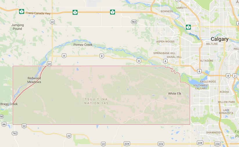
Now, people who visit Google Maps can search for an Indigenous community, such as a reserve, and see an outline of the lands appear on the map.
WATCH: National Aboriginal Day renamed National Indigenous Peoples Day

“One of the first things people want to do when they look at a map is they want to find their home,” said Steve DeRoy, who is Anishinabe from the Ebb and Flow First Nation in Manitoba. He is a director with The Firelight Group and collaborated with Google on the project.
“When people searched for their home, it would be a blank map. This was really the impetus for the project: getting Indigenous lands reflected and recognized on Google’s base maps,” he said.
“It’s important because Indigenous Peoples are an important fabric of Canada, and to not see Indigenous Peoples reflected on those maps, it’s unfortunate.”

Get daily National news
DeRoy said that for this project, he mostly drew on data from Natural Resources Canada, which showed the boundaries of reserve and settlement lands across the country.
This Natural Resources Canada data only contains “established and legally registered lands,” so would not reflect any cases where boundaries may be in dispute, said Google spokesperson Alexandra Hunnings.
DeRoy said that he expects there will be many additions and changes to the maps. “This is the first iteration. I’m sure there will be feedback that comes back saying that there’s data that’s not being represented.”
Google is asking people and communities to tell them about lands and locations they believe should be added to the maps.
READ MORE: More affordable housing units for Hamilton’s Indigenous community
This isn’t the first set of public online maps showing Indigenous lands either. Native-land.ca for example shows territories, languages and treaty lands.
There has been an “overwhelmingly positive” response to the Google maps so far, said DeRoy, and he was thrilled to be able to work on the project.
“Indigenous Peoples have been here since long before colonization and as we celebrate 150 years of Canada, I think it’s that recognition that Indigenous peoples still exist and are an important fabric of Canada’s population. I hope it helps to further that dialogue and awareness of Indigenous people.”
-
![]() Petition aimed to create AI regulations signed by over 1,000 developers
Petition aimed to create AI regulations signed by over 1,000 developers -
![]() Mississauga approves one-year moratorium on AI data centres to develop regulations
Mississauga approves one-year moratorium on AI data centres to develop regulations -
![]() Carney says decision to rescind ‘Netflix tax’ was made in the interest of affordability
Carney says decision to rescind ‘Netflix tax’ was made in the interest of affordability -
![]() New Brunswick politician’s speech sparks viral reaction over apparent AI-generated lines
New Brunswick politician’s speech sparks viral reaction over apparent AI-generated lines


Comments
Want to discuss? Please read our Commenting Policy first.