

Near warning-level winds possible before a spring storm moves in for Easter weekend.

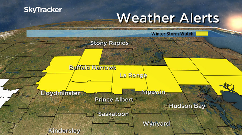
Winter Storm Watch
A winter storm watch has been issued for the Meadow Lake, La Ronge, Buffalo Narrows, La Loche and Pelican Narrows areas as a major spring storm is forecast to bring up to 50 centimetres of heavy snow to central and northern Saskatchewan on Friday.
Environment Canada says to avoid travel if possible in these areas.
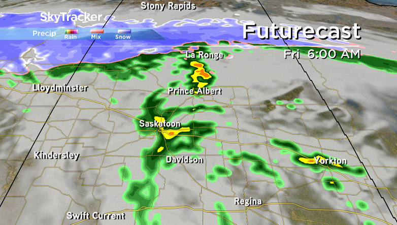
A major low pressure system will develop over Montana on Thursday, and bring heavy snowfall into west-central, and northern Saskatchewan Thursday night, and Friday.
Precipitation will begin as rain over southern sections Thursday night and change to snow on Friday with very high snowfall rates leading to substantial visibility reductions in snow on Friday.
Very high snowfall rates will lead to substantial visibility reductions in snow on Friday.
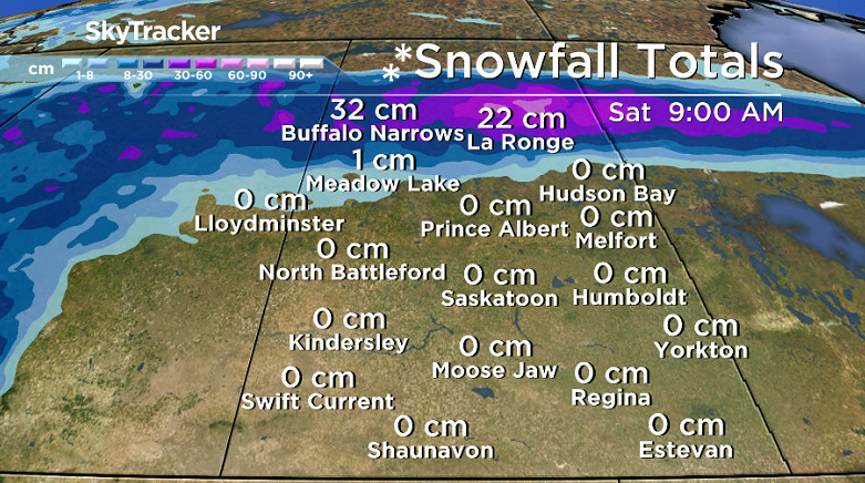
The Meadow Lake region is currently forecast to lie on the rain snow boundary resulting in a high degree of uncertainty with the snowfall accumulations at this point, but total accumulations of 20 to 40 centimetres are forecast with the potential for locally 50+ centimetres.
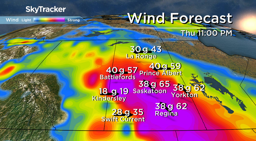
Strong southeasterly winds of 50 gusting to 80 km/h are forecast in advance of the low on Thursday for much of southern Saskatchewan.
For the latest weather alerts download the Global News Skytracker weather app for iPhone, iPad or Android.
Motorists planning to head out on roads are advised to use caution and check in with Saskatchewan Highway Hotline before heading out.
Saskatoon Forecast
Wednesday
-6 is what it felt like with wind chill Wednesday morning in Saskatoon as temperatures fell back to -3 to start the day with a bit of mist reported at the airport.
We quickly sprung up into high single digits later in the morning under mostly sunny skies.
A daytime high in the low teens was eventually reached by afternoon under partly to mostly sunny skies during the afternoon.

Get daily National news
Thursday
Very windy conditions kick in on Thursday as a strong low pressure system moving north into Montana will set up a strong pressure gradient that’ll pick up sustained wind speeds to 50 km/h with 80 km/h gusts in the afternoon.
That system will keep us in the clouds with a slight chance of showers in the afternoon and evening as the mercury heads up into the low teens for a daytime high.
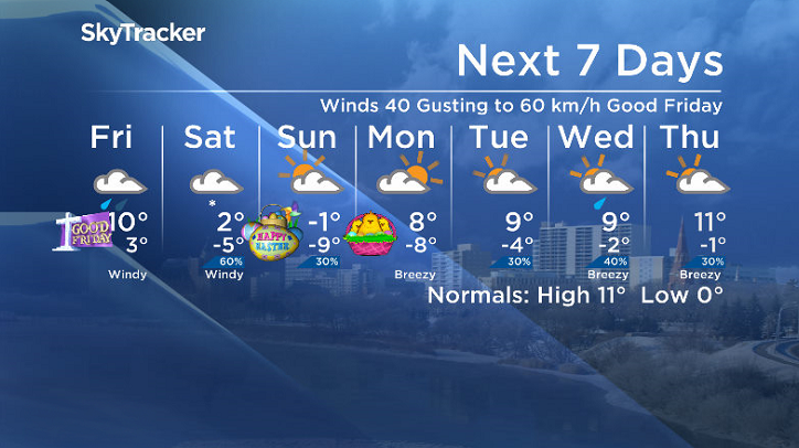
Good Friday
Rain, falling heavily at times, will move into the area early Friday morning as that system slides in right over us, the question is when the rain will taper off – most models are indicating late morning or early afternoon with around 10 to 20 millimetres expected, but a few are keeping them into the evening.


Winds will start out from the east at 40 km/h with gusts of 60 km/h before changing to the north as we get onto the backside of the system during the afternoon cooling temperatures from near double digits into low single digits.
Saturday
Snow looks like it’ll move in on Saturday as the remnants of the system move out and northwesterly winds ease slightly.
Cooler air also slides in, cooling us back below freezing right through the day.
Easter Sunday
Sunny skies do return on Easter sunshine with clouds finally clearing out, however it’ll be pretty cool during the day.
Temperatures will remain below freezing all day with wind chills in minus double digits in the morning, so maybe plan those Easter egg hunts inside this year!

Easter Monday
If you have Easter Monday off, that’ll be the best day for outdoor activities with predominantly sunny skies expected and a daytime high back in mid-positive single digits and a gradual warming trend through the week ahead.
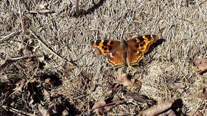
This Your Saskatchewan photo was taken in Wadena by Fred Ponto:
Saskatoon weather outlook is your source for Saskatoon’s most accurate forecast and is your one stop shop for all things weather for central and northern Saskatchewan with comprehensive, in depth analysis that you can only find here.
Comments
Want to discuss? Please read our Commenting Policy first.