


Tuesday, March 07, 2017
Weather forecast update at 4pm:
Good afternoon! Less than a week to go before daylight saving time kicks in. Until then, we have a fairly active weather pattern ahead as a parade of weather systems marches across BC.

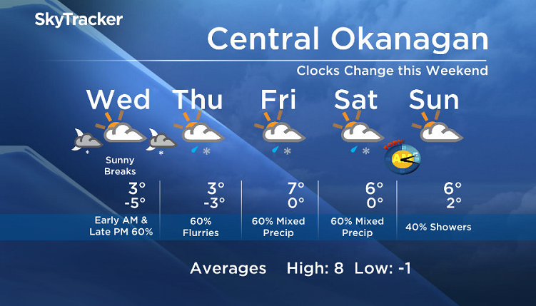
Expect flurries on Tuesday night and Wednesday morning. Although nothing significant is expected in the valleys, areas near the mountains will receive up to 5cm.
We will see a brief break Wednesday midday, but then another wave of precip will start to roll in by Wednesday night for the Central and Southern areas of the valley. (Northern areas will be drier on Wednesday, but all areas will once again see the threat or rain or snow by Thursday afternoon/evening).
Freezing levels will remain near the valley base Wednesday, but signs point to rising freezing levels (to about 1500m) by late Thursday or Friday.
Wednesday’s daytime high range: 0 to +6C
We will have the rest of your weather details coming up at 5, 6:30 and 11pm – hope you can join us!
~ Duane English / Wesla Wong


Comments
Want to discuss? Please read our Commenting Policy first.