

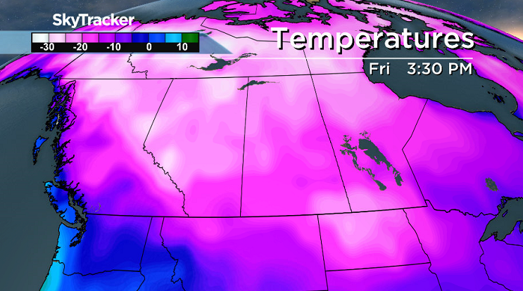
-40 wind chills with daytime highs in the -20s are ahead as even colder arctic air sinks in.

Saskatoon Forecast
Today
It was another bitterly cold start to the day in Saskatoon as temperatures fell back to -18, but that felt like -30 with the wind chill.
You can thank a breezy northwest wind with sustained speeds of 20 to 30 km/h and gusts of 30 to 40 km/h for making it feel so much cooler outside today.
We did start off the day with some very light snow followed by a few sunny breaks in the morning before cloud cover builds back in midday.
Mostly cloudy skies with a good chance of flurries will stick around for the rest of the day with our daytime high expected to be around -14, but feeling in the -20s all afternoon with the wind chill.
Tonight
Some partial clearing tonight is expected to allow temperatures to fall back even cooler, down into the -20s for an overnight low.
Thursday
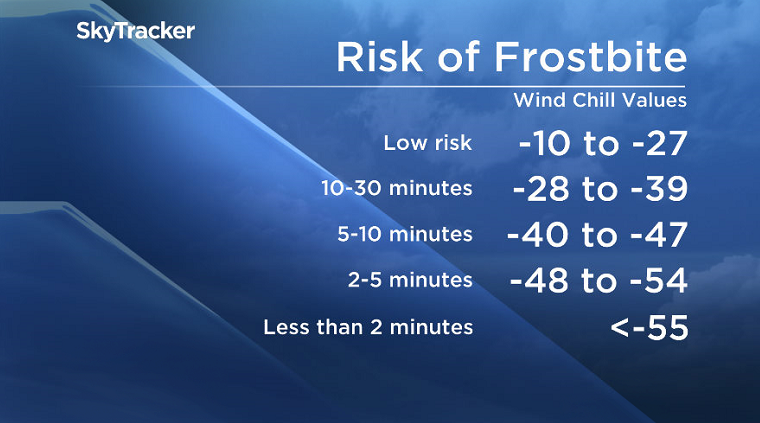
-31 to -32 is where it’ll feel around tomorrow morning with wind chill when you head out, which means your skin can freeze in a matter of minutes.
We’ll start off the day under partly to mostly cloudy skies with a chance of flurries before we get into a few more sunny breaks through the day with an expected high just into the minus teens, but that’ll still feel in the low minus 20s with the wind chill.
Friday
It looks like this massive arctic ridge of high pressure that’s continuing to build in from the northwest will keep us out of the clouds we were initially expecting to move in on Friday.
As such, it’ll be a very chilly start to the day with a morning low in the mid-minus 20s. Thankfully, winds will have eased right off so it won’t feel as cold as it could, but wind chill values are still expected to make it feel like the mid-minus 30s to start the day.
We should see quite a bit of sunshine to end off the work week, but it’ll be deceiving as our daytime high will struggle to get into the minus teens.


Weekend Outlook
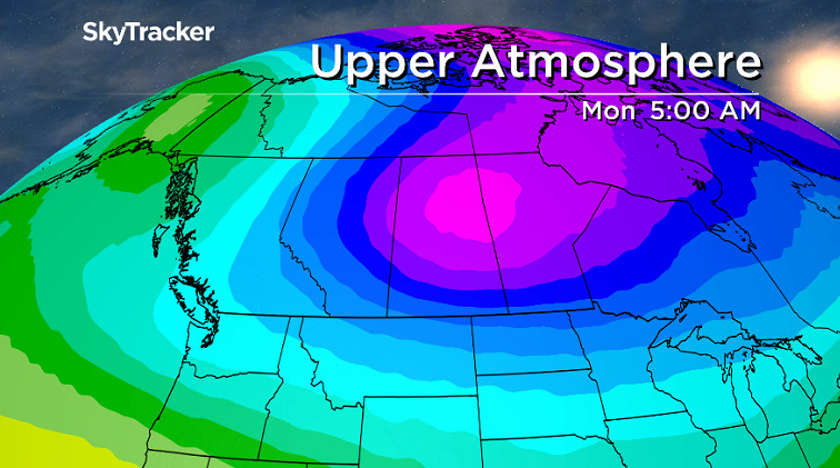
Some of the coldest air on earth associated with the polar vortex, a cool pool of air in the upper atmosphere that normally sits over the North Pole, will push in this weekend into early next week.
That’ll drop daytime highs back into the -20s this weekend under partly to mostly cloudy skies with morning lows into the mid-to-low minus 20s.
Wind chill values could get close to the -40s on Sunday, which is the criteria required for an extreme cold warning to be issued by Environment Canada.
For the latest weather alerts download the Global News Skytracker weather app for iPhone, iPad or Android.
This Your Saskatchewan photo was taken by Jenalle Tari Bahm in Kerrobert:

READ MORE: Get a 2017 Your Saskatchewan calendar today
Saskatoon weather outlook is your one stop shop for all things weather for Saskatoon, central and northern Saskatchewan with a comprehensive look at your local forecast that you can only find here.
Comments