
Friday, November 25, 2016 – Weather forecast update at 5am:

The breezy conditions and the threat of showers will ease off this morning.
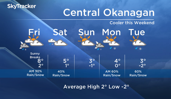
Expect decreasing cloud with sunny breaks by midday when the low over our region weakens.
The email you need for the day's
top news stories from Canada and around the world.
Clouds will return to our region tomorrow under an upper trough. Isolated showers are a possibility for the Okanagan on Saturday, with accumulating snow on the local mountains.
On Sunday we will be in between systems, but an unstable northwesterly flow will bring the return of rain and snow to the BC Southern Interior by Sunday night.


Today’s daytime high range: 3 to 8C
We will have the rest of your weather details coming up at 5 and 6:30 and 11pm – Hope you can join us!
~ Duane/Wesla
More on Canada
- Fall COVID-19 vaccine guidelines are out. Here’s what NACI recommends
- Thousands of Canada’s rail workers have a strike mandate. What happens now?
- Some 2019 candidates ‘appeared willing’ to engage with foreign interference: Hogue inquiry
- Bird flu: Experts urge more surveillance in Canada — before it’s too late
Comments