
TORONTO – At 10:29 p.m. EDT, summer will officially end.

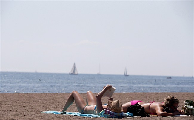
This year, Canada’s summer was pretty normal. After all, it was full of the typical fare: tornadoes, heat waves (B.C., we’re looking at you), hail and…snow?
Okay, with the exception of that last one, it was average, though.
“If we factor in June, July, August and September it actually turned out to be warmer than normal across the country,” said Environment Canada’s senior climatologist David Phillips. “And significantly so.”
Environment Canada uses records that go back to 1948. Using that time frame, this summer was the sixth warmest, being about 1 C above normal.
The warmest spots were the Pacific and Atlantic coasts. In the west, it was the third warmest; the east, the fourth. Going up north, to the Northwest Territories, it was the seventh warmest.
But try telling that to those in Ontario and western Quebec where temperatures were below the normal mark, though not by a lot: .2 C.
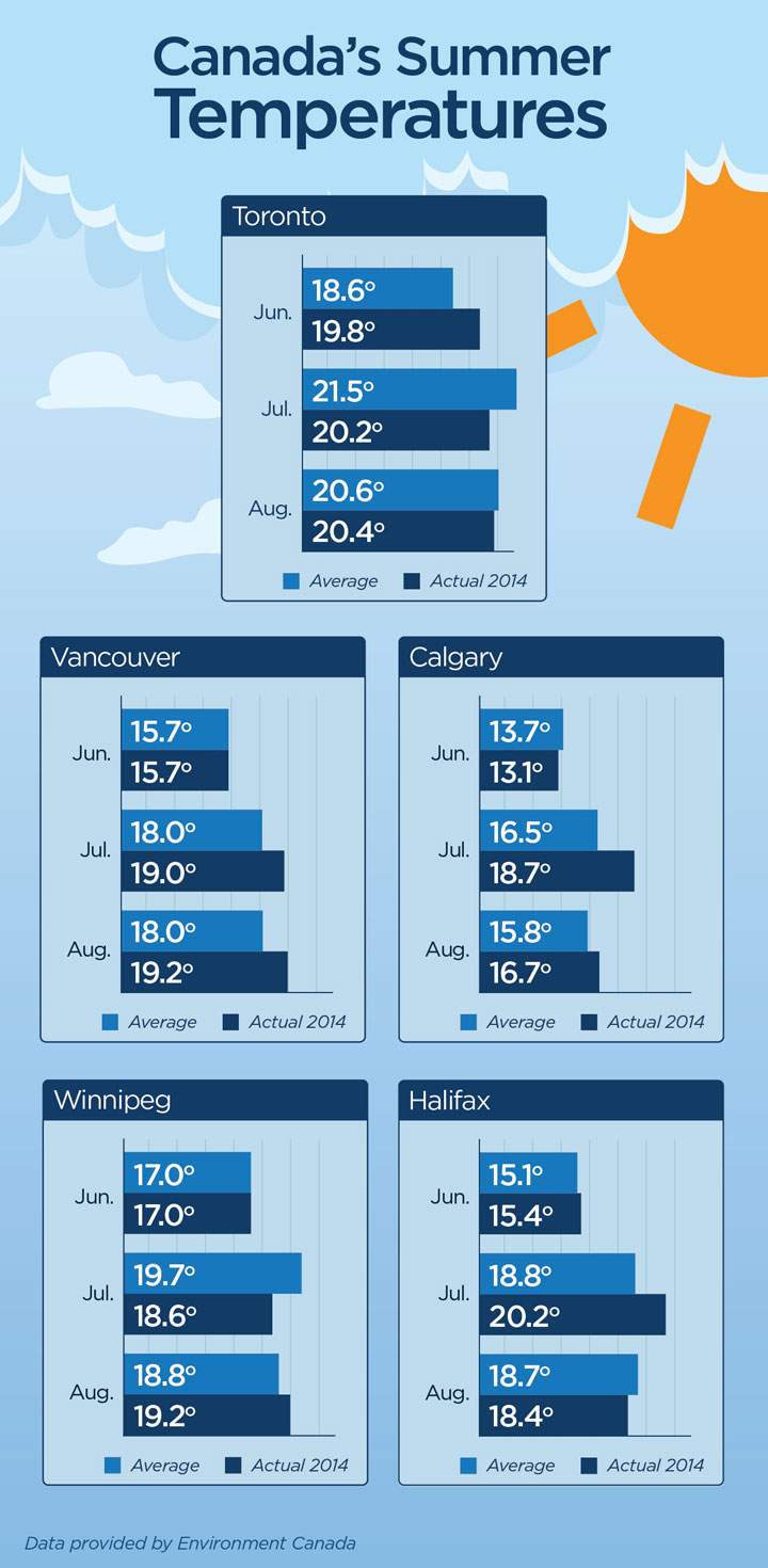
In Toronto, for example, though May and June were warmer than normal, July and August – a time when most people expect the hottest weather – were cooler than normal.
The Prairies were near normal – warmer by about .2 C, but that was mainly due to Alberta and parts of western Saskatchewan. Manitoba was, in fact, a bit cooler.

Get daily National news
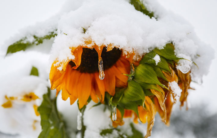
Then there was that whole snow thing in parts of southern Alberta.
“It was a bit of a shock, even to Calgarians,” Phillips said. “They know they’ve had snow in every month, but it was unusual for two reasons: one, it was a significant amount of snow…they got 28 cm of snow…and also it came so early.”
“It was a snowier summer than normal,” Phillips said, laughing.
Fortunately for those in Calgary, a return to warm – even warmer than normal temperatures – followed.
Precipitation-wise, it was the 14th wettest in 67 years. But some areas were actually quite dry, such as the Pacific where it was the fifth driest summer on record.
In the meantime, the week ahead looks to bring higher than normal temperatures to most of Canada. In Saskatchewan temperatures could reach almost 30 C.
“Maybe for places in Ontario, parts of Quebec, and the Prairies, maybe the best week of the entire year,” Phillips said. “We’re seeing temperatures in Toronto that are four or five degrees warmer than normal. On the Prairies, we’re seeing temperatures that are a dozen degrees to 15 degrees warmer.”
Looking ahead to winter – after the coldest Canadian winter in 67 years – Phillips said that it’s a bit too early to tell. There is a weak El Nino occurring in the Pacific, which could influence the forecast. Still, it doesn’t look to be as bad as last year.
READ MORE: Weather challenge – Who had the worst winter in Canada?
“I think it comes down to the fact that people, their memories are last winter, which was really cold, really tough, really long. And everything about it it was nasty,” Phillips said. “Comparing it to last year is fairly easy: it won’t be as rough, it won’t be as long.”
“It may be colder than normal, but it won’t be the record cold, the stinging cold that went on week after week, month after month.”
“It won’t be the bogey man of the winter… This one will be somewhat less difficult.”
Phillips added, “But, hey, there’s no guarantee.”


Comments
Want to discuss? Please read our Commenting Policy first.