
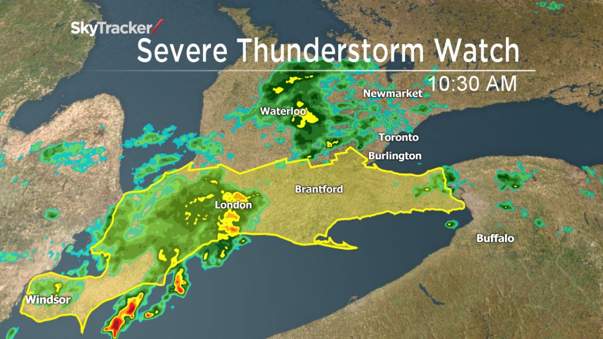
TORONTO – It was another wet day for parts of southwestern Ontario, though the threat of severe thunderstorms seems to have passed.

Environment Canada issued a severe thunderstorm watch for the following regions early Tuesday morning:
- Simcoe – Delhi – Norfolk
- Dunnville – Caledonia – Haldimand
- Sarnia – Lambton
- Windsor – Essex – Chatham-Kent
- London – Middlesex
- Elgin
- Oxford – Brant
- City of Hamilton
- Niagara
Not included in the watch was Burlington which received 125 mm of rain over just two days this past weekend. However, rain is still expected today.

Get daily National news
Fortunately, the lingering cloud system stifled any real daytime heating, which prevented any storms from forming. However, rain did move across the London and Brantford area throughout the late morning and early afternoon.
Remember to keep an eye on the sky. If threatening weather approaches, seek shelter. As well, keep away from flooding roads: it’s often difficult to ascertain just how deep the water is and it can pose a danger.
To get real-time weather for your area, download the Global News Skytracker weather app.
WATCH: Will the severe weather effect the evening commute in the GTA?
Comments