


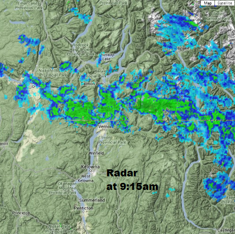
Here’s a look at the radar at 9:15 am – we have scattered flurries for the northern regions and parts of the eastern areas this morning, but as for the central and southern regions – this first half of the day is the calm before the storm.

By this evening, almost all of the Southern Interior will see rain or snow.

Get daily National news
Get daily Canada news delivered to your inbox so you'll never miss the day's top stories.
By providing your email address, you have read and agree to Global News' Terms and Conditions and Privacy Policy.
Freezing levels will rise and most areas by the lake will see precip fall as rain but the mountain pass summits will see heavy snow at times tonight.
Tonight’s storm accumulation amounts for the Southern Interior highway summits will be between 10 to 30cm.


As freezing levels continue to fluctuate, the precip could turn to rain on Saturday even at higher elevations.
Today’s High: 1 to 5C
Tonight’s Low: 1 to 5C
~Wesla/Duane


Comments
Want to discuss? Please read our Commenting Policy first.