


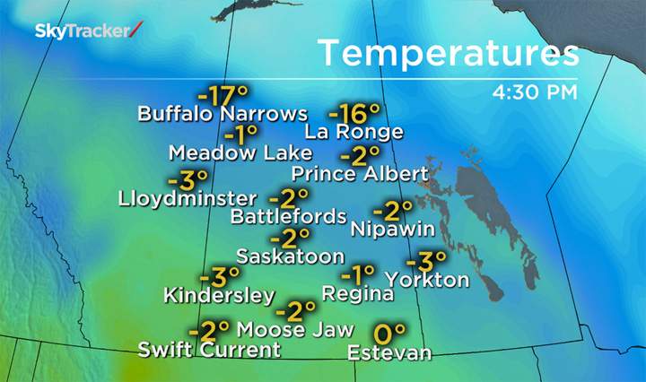
SASKATOON – After a December that has been an average of about 6 and a half degrees below seasonal, residents of southern and central Saskatchewan have had a mild ‘heat wave’ move in.

While temperatures remain a few degrees shy of breaking high temperature records for Saskatoon, a 3 degree reading on thermometers Sunday evening was welcomed by many.
Especially after a stretch of nearly two weeks in the minus double digits.
Typically in December, daytime highs are around -9 and overnight lows near -19.

Get daily National news
Sunday’s warm-up came suddenly and quickly. At 4 p.m. the temperature was -6 and it rose to 1 by 5 p.m. and topped out at 3.4 degrees.
Usually temperatures start falling in the late afternoon as the sun sets in Saskatoon.
The reason for the warmth is thanks to a strong low pressure system sitting in Nunavut, which has ushered in the warmth over parts of the southern prairie provinces.
That same system that brought in the balmy air will turn on us as it crashes in a cold front, which will move through Wednesday.
Behind the front will come chillier air that will see daytime highs in the negative teens and into the minus 20’s by the end of the week.
In total, two high temperature records came falling down in Saskatchewan on Sunday.
Lloydminster’s daily high of 5.3 degrees shattered their previous record of 3.9 from 1991 and Buffalo Narrows hit 2.6 just edging out a record set in 1997 of 2.5 degrees.
Want your weather on the go? Download Global News’ Skytracker weather apps for iPhone, iPad and Android.




Comments
Want to discuss? Please read our Commenting Policy first.