
Mild temperatures and a chance for flurries start the week but winter is expected to make a statement later in the week.

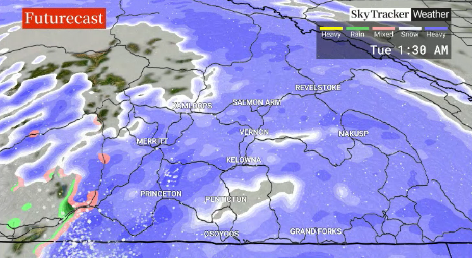
Heavy snow rolls in Monday night into Tuesday morning along a frontal system with a snowfall warning for up to 10 centimetres is expected.
The mercury makes its way just above zero for a daytime high as the risk of flurries lingers into the day before some clearing on Wednesday with a high around 0 C.
More snow is expected Thursday as daytime highs dive with a surge of arctic air.
Temperatures tumble down to the -20s C both Friday and Saturday mornings with highs in the minus teens under a mix of sun and cloud.
A gradual warm-up eventually arrives later in the weekend.


For weather on the go download the Global News SkyTracker Weather App for iPhone, iPad or Android.
Comments