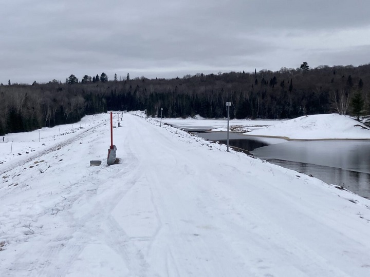
It’s unclear when about 700 people can return to their properties in Quebec’s Laurentians region after they were forced out earlier this week because of fears a dike on a nearby river could fail, Public Security Minister François Bonnardel said Tuesday.

Authorities are planning to start repair work by this weekend or early next week on the dike — whose reservoir can retain up to 382 million cubic metres of water, the equivalent of more than 100,000 Olympic-size swimming pools. Flood maps show that up to 2,000 buildings could be impacted if the dike bursts, and parts of the area could suffer landslides, officials said.
“It would be inadequate to fix a return date — we don’t know what could happen, (including) additional surprises,” Bonnardel told a news conference.
The Public Security Department ordered hundreds of residents to evacuate Sunday from the municipalities of Chute-St-Philippe, Lac-des-Écorces and Lac-Saguay. The three communities are located close to each other by the Kiamika River, and about 125 kilometres northeast of Ottawa.
Bonnardel, who visited civil security officials and displaced residents on Tuesday, said the vast majority of people are staying with family or friends outside the region, adding that about 145 of them are housed in hotels or inns in the area. He reassured residents and affected municipalities there would be financial help from the provincial government.

Get daily National news
Martin Ferland, an engineer with the Environment Department, said the province built a road on Monday for heavy machinery to access the Morier dike, which was built in 1954 and is owned by the government. Teams were working hard to reduce the risk of a breach and were evaluating the situation, he said.
In the short term, the dike will be fitted with a reverse filter to catch water seepage from parts of the structure that are eroded, Ferland said. By the end of the week or early next week, he added, construction will begin on a berm to divert water and stabilize the dike. A new hydrometric station will be installed Wednesday to monitor water levels, and drones will be flown to monitor the area.
Roughly 2,000 buildings could be impacted, according to flood maps. Ferland said the area at risk of flooding includes buildings of all kinds, homes, and roads, adding that parts of the region are at risk of landslides.
“There aren’t entire towns, but important zones that could be flooded,” Ferland said. “The level of flooding is variable according to the sectors, the topography, the conditions after a rupture.”
During the most recent monthly inspection, officials found structural weaknesses in the Morier dike that could lead it to burst. Authorities suspect internal erosion to be the cause of the structural damage.
- Canadians say Puerto Vallarta a ‘war zone’ amid escalating violence
- As Carney heads to India, Canada seeks to revoke citizenship of 2008 Mumbai attack ‘mastermind’
- Vancouver airport ties Nexus outage to U.S. partial government shutdown
- What’s a Canadian firm under defence industrial strategy? It’s complicated


Comments
Want to discuss? Please read our Commenting Policy first.