
It’s going to be a much cooler week in the Okanagan.

Partly-to-mostly cloudy skies returned to the valley bottom on Monday with an afternoon high aiming for the low teens.
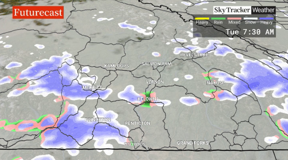
Snow levels will fall from 1,200 metres to near the valley bottom Monday night into Tuesday morning with five to 10 centimetres possible for higher elevation travel routes.
Tuesday will see a return to showers and clouds with temperatures during the day headed to around 7 C.
Clouds return Wednesday and Thursday as the mercury makes its way back into mid-single digits.
Skies clear to finish the week on Friday as daytime highs continue to hover in single digits.
The final weekend of October will bring a return to mostly sunny skies with highs staying in mid-single digits.


For weather on the go download the Global News SkyTracker Weather App for iPhone, iPad or Android.
Comments