
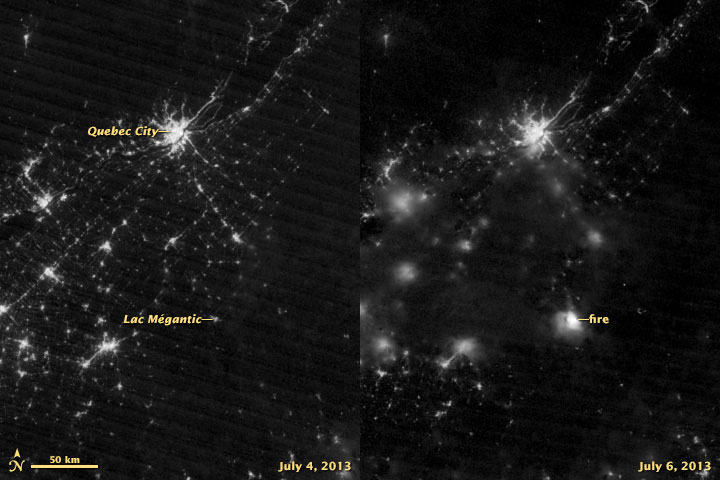
TORONTO – The devastating Lac-Mégantic explosion that killed at least 13 people and destroyed the small town was captured by the NASA Suomi NPP satellite.

Suomi used its Visible Infrared Imaging Radiometere Suite (VIIRS) to image the fire which began after a train derailed and its oil cars exploded wiping out much of the small, Quebec town.
Breaking news from Canada and around the world
sent to your email, as it happens.
The image on the right was taken at 6:59 EDT by VIIRS’s day-night band. It detects light in a range of different wavelengths from green to near-infrared.
The image on the left shows the same area on July 4.
(The image on the right is slightly blurred due to cloud cover.)
Comments