

Storm slams Saskatoon with what the city is calling a “one in 25 year storm,” but drier days are ahead.

Storm Report
Monday’s severe thunderstorm slammed Saskatoon with up to 50 millimetres of rain in some parts of the city.
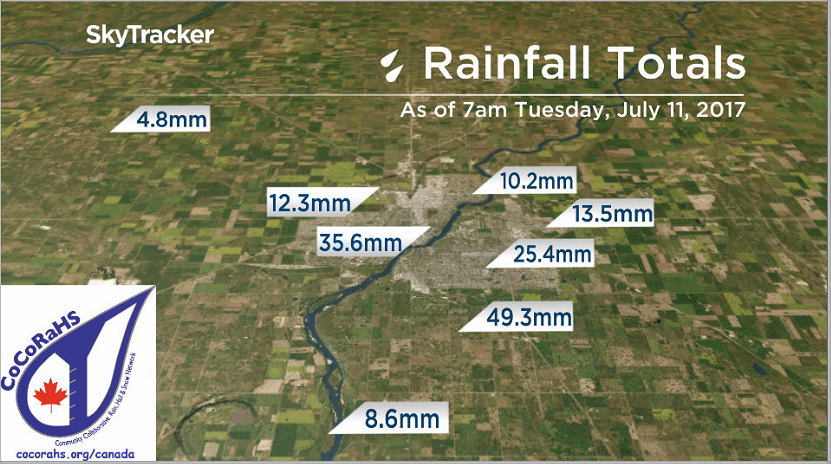
The City of Saskatoon is calling it a “one in 25 year storm” in parts of the city.
It sparked up quickly and was a slow moving storm that resulted in flooded intersections, power outages and up to quarter-sized hail reported in the city.
READ MORE: Saskatoon pummeled by severe thunderstorm

There was an unconfirmed tornado reported 8 kilometres west of Laporte at 4:15 p.m. with no damage reported, and up to golf ball-sized hail in Eatonia and Saskatchewan Landing Provincial Park.
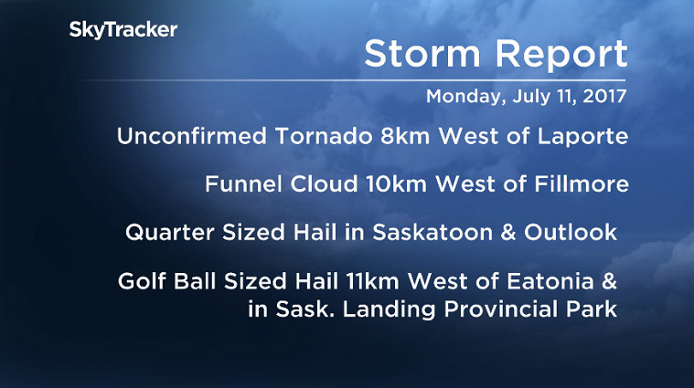
A funnel cloud was also reported 10 kilometres west of Fillmore around 6:20 p.m. as storms roared across both central and southern Saskatchewan well into the evening.
The system responsible for the severe weather is now moving east, however a severe thunderstorm watch and weather advisory for possible funnel clouds was issued Tuesday morning in southeast Saskatchewan.
Saskatoon Forecast
Tuesday
Much calmer conditions moved into Saskatoon Tuesday, with dark clouds sticking around through the day after we fell back to 16 degrees in the morning.
We managed to make it up to 20 degrees under mostly cloudy skies by noon with an east-northeasterly wind kicking in around 20 km/h.
Gloomy conditions stuck around for the rest of the day as we warmed warm up to a daytime high around 20 degrees.
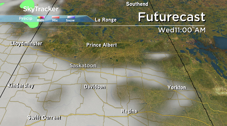
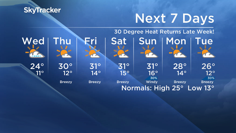
Wednesday
Some cloud will linger during the morning hours on Wednesday before clearing out later in the day to give us some afternoon sunshine.
Temperatures will also recover back up into the mid 20s for a daytime high later in the afternoon.


Thursday-Friday
Our heat machine, the upper ridge of high pressure, will build back in for the rest of the week.
It will return us back into mostly sunny skies with daytime highs back into the 30s both Thursday and Friday.
Weekend Outlook
That ridge looks like it’ll hang on for the weekend with afternoon highs staying in the low 30s both days and mostly sunny skies on Saturday before a few more clouds with a chance of thundershowers moves in on Sunday a trough swings through.
Dale Boan took this Your Saskatchewan photo of Monday’s storm near Bradwell:

Saskatoon weather outlook is your source for Saskatoon’s most accurate forecast and is your one stop shop for all things weather for central and northern Saskatchewan with comprehensive, in depth analysis that you can only find here.
Comments