Advertisement

In photos: Science and art come together on Mars

A turquoise field of dunes lies on the floor of one of the oldest places on Mars, the Noachis Terra crater. This isn't how we'd see the dunes: infrared has been added to this image to create the colour. NASA/JPL/University of Arizona

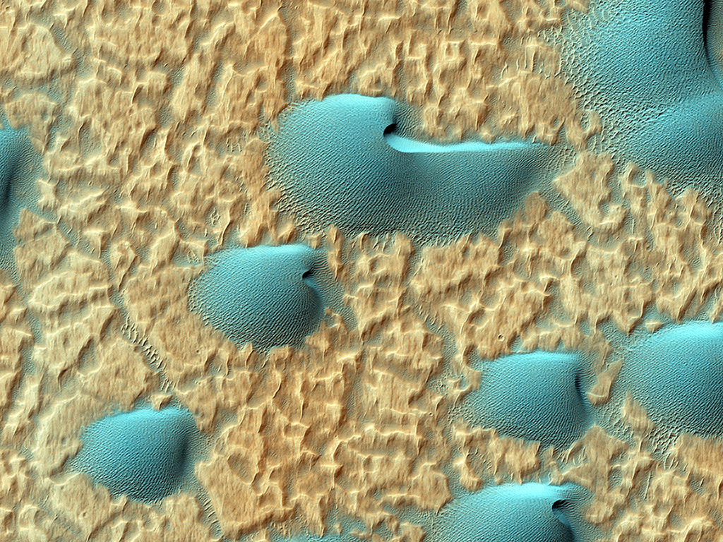
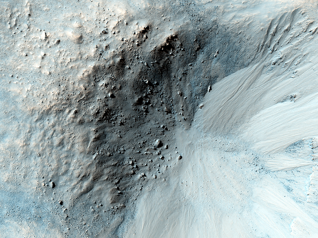
TORONTO – They are colourful, dynamic portraits that could hang in a art museum. But instead of paint on a canvas, these landscapes have been created by time and the laws of nature and the forces that guide our universe.

Thanks to a camera aboard NASA’s Mars Reconnaissance Orbiter (MRO) called the High Resolution Imaging Science Experiment (HiRISE), we are seeing Mars not as the barren, rock-strewn, red planet we have come to know, but rather a body in our solar system that is dynamic and rich with beauty.

Beam me up. These unique sand dunes, reminiscent of the communicator badge used in the Star Trek franchise, lie in a large crater near Mawrth Vallis. NASA/JPL/University of Arizona
Line in the sand. This image shows a volcanic vent on Mars. Scientists hope to better understand volcano-tectonic processes on the planet by studying images like this one. NASA/JPL/University of Arizona

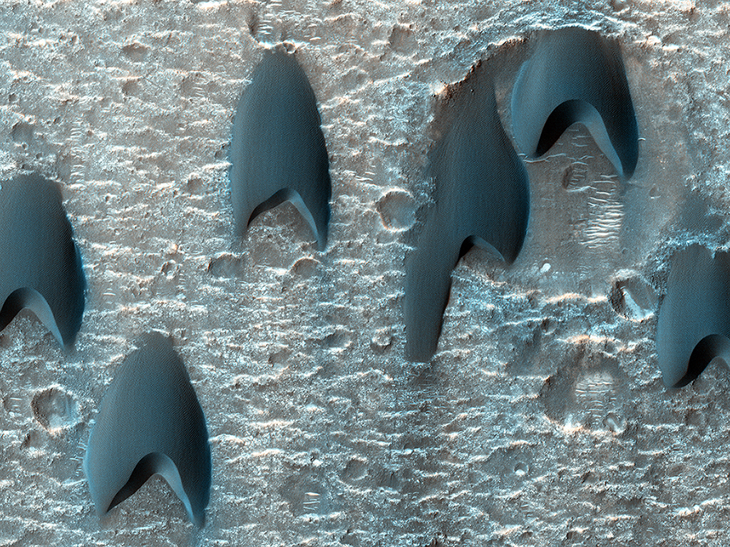
HiRISE operates in visible wavelengths, but also has the ability to photograph in infrared light, allowing scientists to collect data on minerals on the planet, teaching them about the planet’s complicated and still unknown geology.

Story continues below advertisement

What is more spectacular is that HiRISE produces extremely high-resolution images. Using its visible light camera, it can distinguish objects that are just one metre in diameter from an altitude of about 200 to 400 kilometres.

Ancient landslides. This image shows an approximately 3-billion year-old landslide in Ophir Chasma. NASA/JPL/University of Arizona
Brain freeze. This image shows icy features wrapping around a small hill. The base has an unusual texture which has lead it to be nicknamed the “brain terrain.” NASA/JPL/University of Arizona

The MRO was launched on August 12, 2005 and arrived on Mars March 10, 2006. Since then, its numerous scientific instruments continue to operate and collect data about Mars.

Story continues below advertisement

The orbiter’s mission is to study the history of water on the planet, as well as small-scale features.

Bird in the sand. This bird-like dune lies in Mars’s north polar region. The bright spots are carbon dioxide frost. During the spring the frost sublimates (turns directly from a solid to vapour), producing jets of carbon dioxide mixed with dust leading to the dark features seen in the image. NASA/JPL/University of Arizona
Bullseye. Though most impact craters are bowl-shaped, this crater is more unusual, as it has a wide, flat bench between its outer rim and inner section. NASA/JPL/University of Arizona
Gullies and ravines. An impact crater, about 900 meters wide is surrounded by gullies on all its inner slopes except in the northwest. The crater lies in the Libya Montes region on Mars. NASA/JPL/University of Arizona

Incredibly, the high-resolution also spotted the tracks of the Mars rover Curiosity as it trekked across Mars.

Story continues below advertisement
WATCH: Curiosity Trekking
Hints of water? These lines are called recurring slope linae (RSL), which could be due to active seeps of water. These RSLs abundant along the slopes of ancient bedrock in Coprates Chasma. NASA/JPL/University of Arizona
High on the Tharsis rise in the upper parts of the Valles Marineris canyon, windblown sediments create this image of contrasts. NASA/JPL/University of Arizona

In 2007, HiRISE also provided a spectacular image of our home.

Story continues below advertisement
Home sweet home. Earth and the moon as seen from HiRISE, 142 million kilometres away. NASA/JPL/University of Arizona

The mission is still going strong. And while the scientists collect data and help to expand our knowledge about the formation of other planets in our solar system, we reap the benefits with their breathtaking portraits.

Sponsored content

AdChoices