

Manitoba was able to dig itself out relatively easily after a spring snowstorm hit earlier this week, but our neighbours to the south weren’t quite as lucky.

On the other side of the Canada/U.S. border, North Dakota was hammered with a consistent blanket of snow, with some areas seeing up to 28 centimetres.
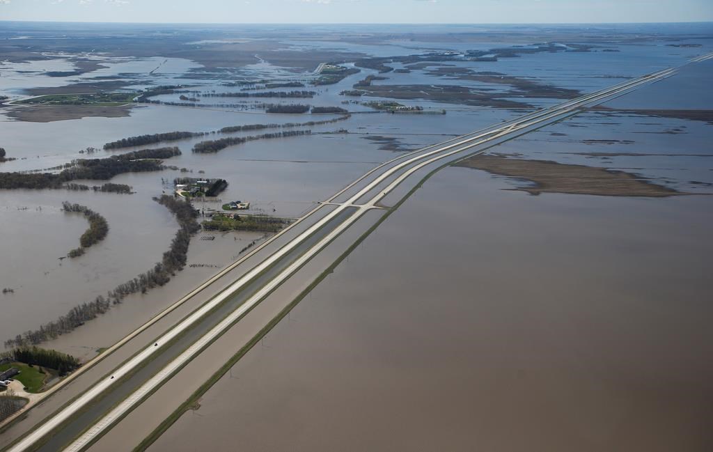
That amount of precipitation has the potential to impact Manitoba when it melts, and flood watchers are paying close attention.
Thomas Grafenauer, a meteorologist with the U.S. National Weather Service, told 680 CJOB’s The Start that the added snowfall is certainly contributing to flooding concerns — and that the 28 cm of snow will contain about three to four cm of water.
“I think it just adds confidence to the fact that we’re going to receive widespread moderate to major flooding along the Red River main stream and the southeast North Dakota tributaries,” Grafenauer said.

Get daily National news
Previous flooding estimates, he said, did leave room for potential future precipitation, so the overall risk remains moderate.
“The forecast that we issued two or three weeks ago, they did account for future precipitation. … And really, I think what this storm does to the flood outlook is that it really eliminates the ‘no future precipitation’ scenarios.”

On the Canadian side of the border, Manitobans may have to wait a little longer to be rid of the snow that fell over the past 24 hours.


Environment Canada meteorologist Rose Carlsen told The Start that the warm-up expected for this weekend is still forecast to happen, but on a smaller scale.
The previously-promised double-digit highs on Sunday are now looking like they’ll remain on the plus side, but only around 3 C.
“Because we are so cool now and we have all this snow on the ground, that’s going to take quite a bit to melt and relinquish its effect on the air temperature.”
And while the snow has stopped falling, there are still some concerns over high winds on Thursday morning.
“The winds are still a little gusty, … but we’re expecting those winds to ease through the day,” Carlsen said.
“Any blowing snow that’s still remaining will also diminish along with those winds.”

Comments