

Hurricane Ian made landfall in Florida Wednesday as one of the strongest hurricanes ever to hit the U.S., unleashing howling winds, torrential rains and a treacherous surge of ocean surf.

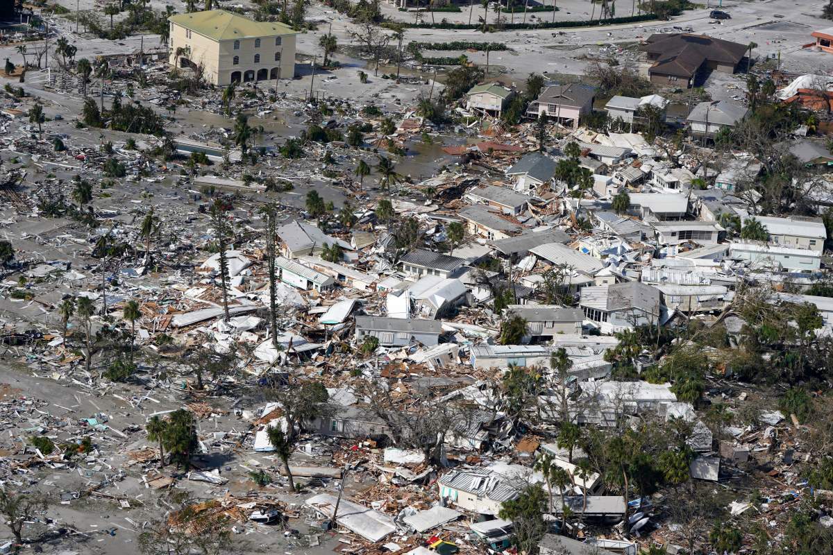
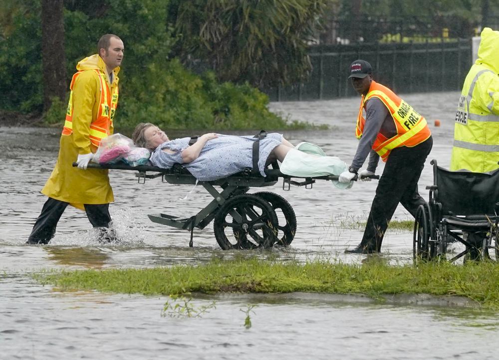
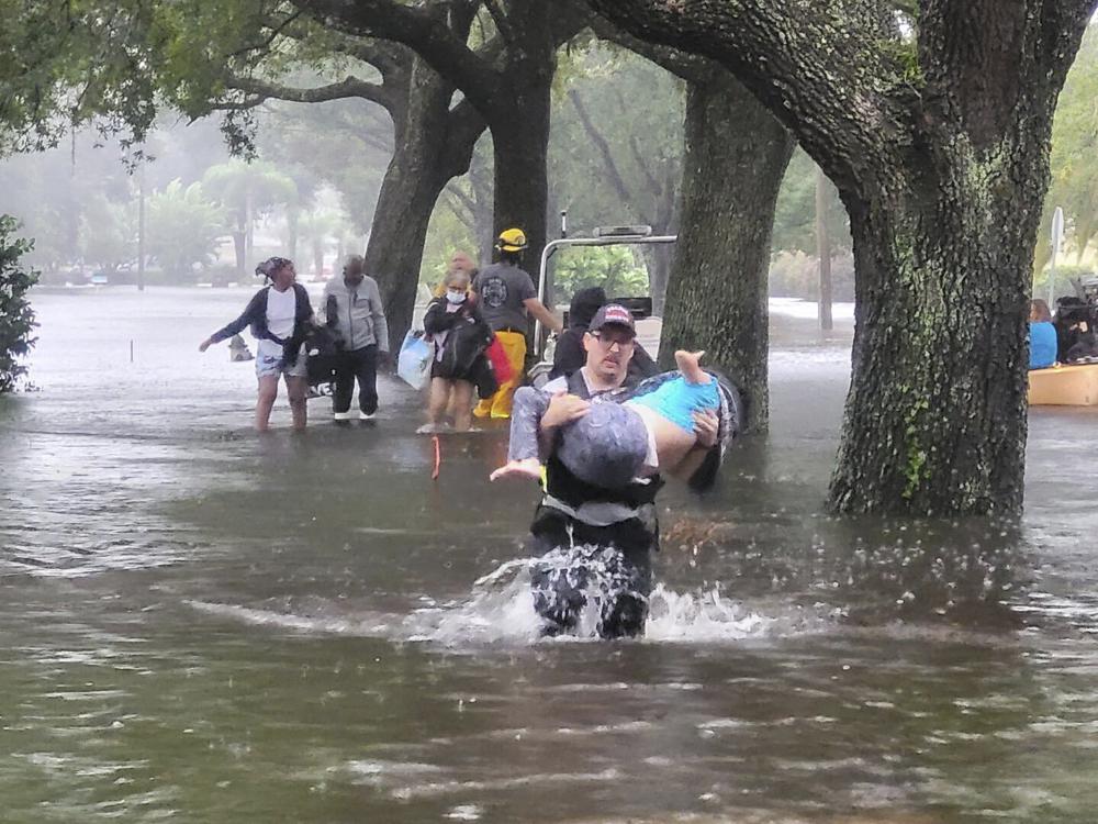
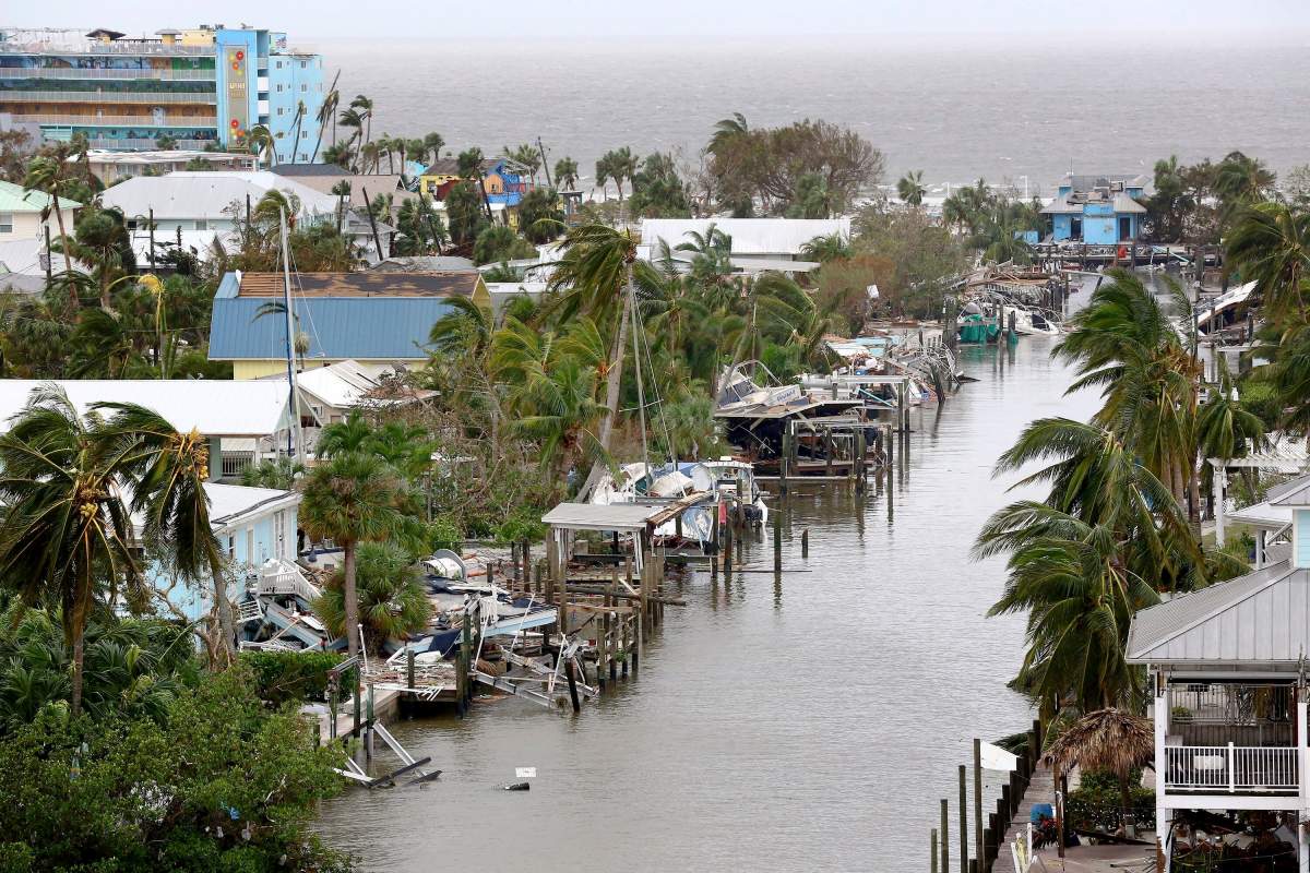
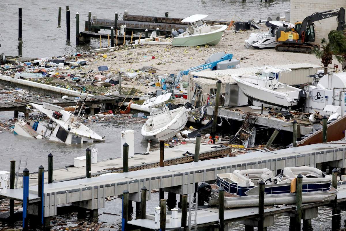
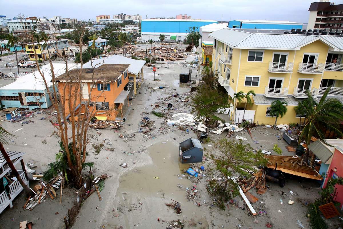
Early video images of the storm’s fury on local TV and social media showed flood waters sweeping away cars, nearly reaching rooftops in some communities and the ruins of homes as palm trees were bent almost in half.
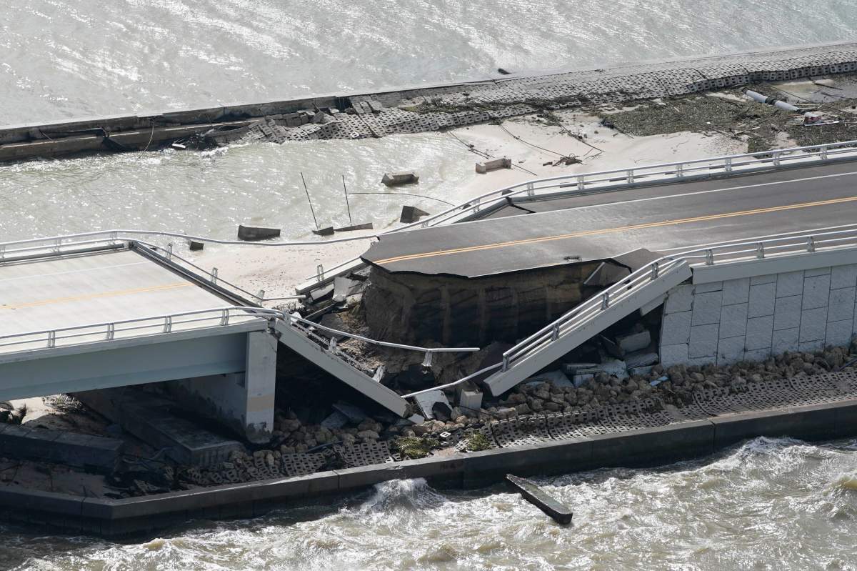
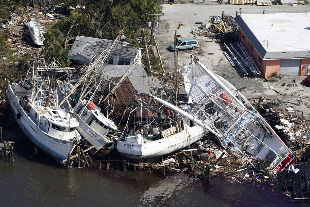
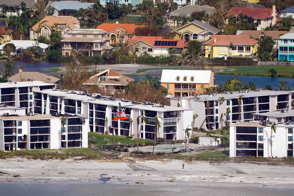
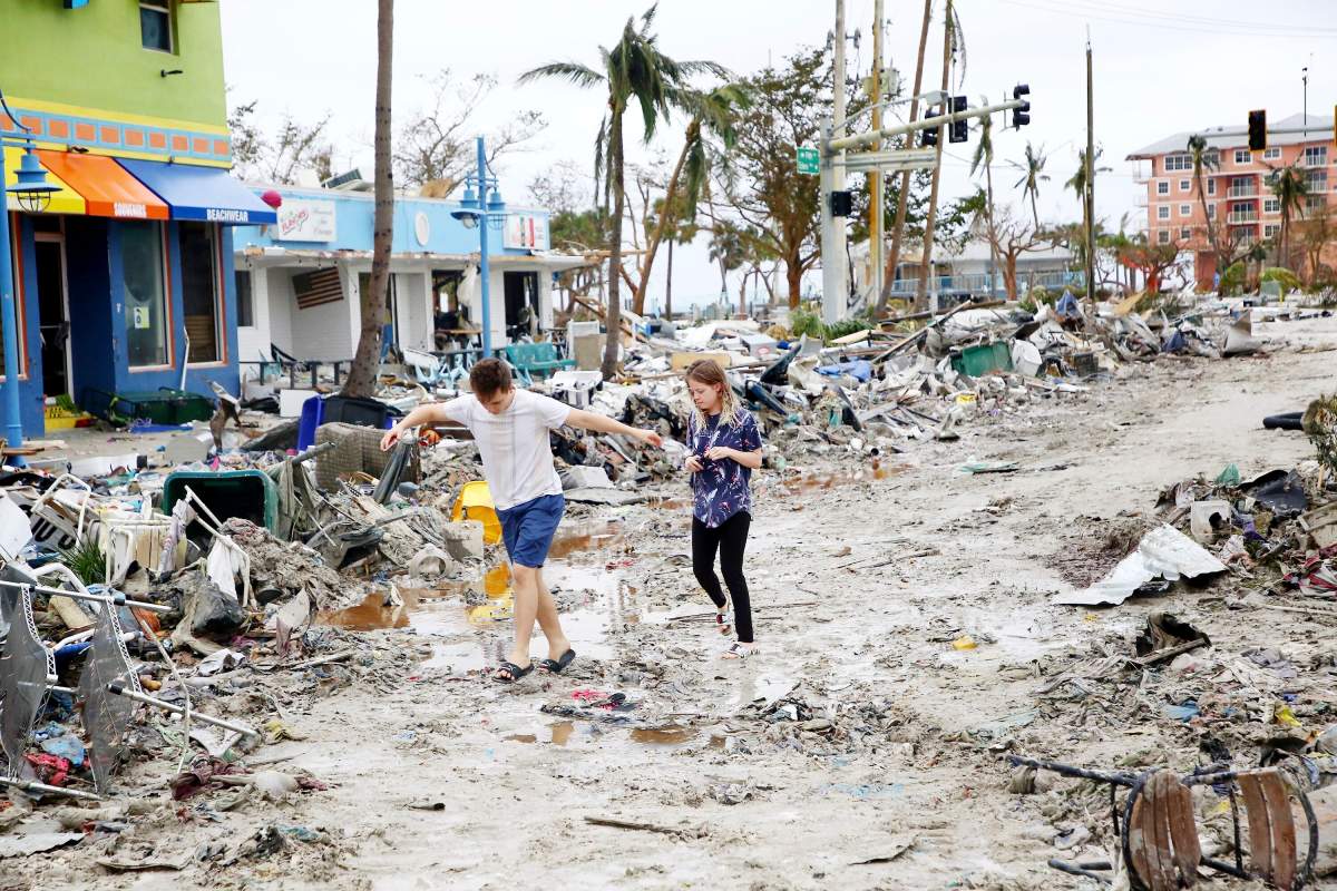
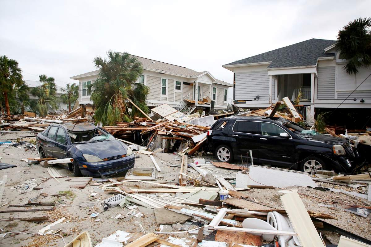
The Associated Press reported a day later that the storm flooded homes on both of the state’s coasts, cut off the only bridge to a barrier island, destroyed a historic waterfront pier, and knocked out electricity to 2.67 million Florida homes and businesses. At least one man was confirmed dead as of Thursday.


“This storm is doing a number on the state of Florida,” said Governor Ron DeSantis Wednesday, who asked U.S. President Joe Biden to approve a major federal disaster declaration providing a wide range of U.S. emergency aid to the entire state.

Get daily National news
U.S. border authorities said 20 Cuban migrants were missing after their boat sank off the Florida coast as Ian neared the coast on Wednesday.

There were no immediate official reports of other storm-related casualties.
An unknown number of people were stranded in “high-risk” evacuation zones and in need of help after defying orders to seek higher ground, but rescue crews were unable to immediately reach them, the governor said.


The storm’s peak wind speeds put it just shy of a Category 5 designation on the Saffir-Simpson scale, the maximum classification.
- Sawmill closures ‘gut-wrenching’ amid lumber industry headwinds: Canfor CEO
- Global burning at record low, despite North American and European wildfires
- Judicial review request challenges denial of Corb Lund’s ‘Water Not Coal’ petition
- France lets 84K evacuees go home as wildfires spread across Europe


Climate change is making hurricanes wetter, windier and more intense. There is also evidence that it is causing storms to travel more slowly, meaning they can dump more rain in one place, scientists say.
Read more: Hurricane Fiona shows how climate change is fuelling severe weather events in Canada: expert
“Hurricane Ian’s rapid intensification could prove to be another example of how a warming planet is changing hurricanes,” said Kait Parker, meteorologist and climate scientist at IBM’s weather.com.
“Research shows we are seeing this far more often than we did in decades past.”

After weakening to a tropical storm over Florida, Ian was nearing hurricane strength again over the Atlantic Ocean. The coast of South Carolina was put under a hurricane warning.
Ian’s top sustained winds grew to nearly 70 mph (110 km/h) at midday Thursday, just shy of hurricane force, with higher gusts.


– with files from Reuters and The Associated Press
Comments
Want to discuss? Please read our Commenting Policy first.