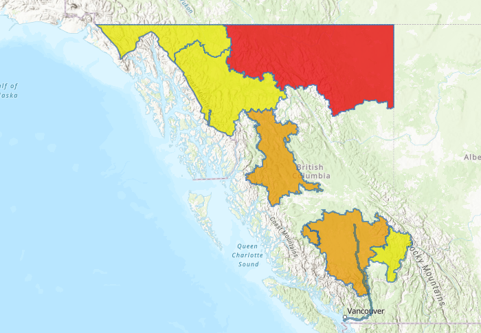
The Cariboo Mountains and surrounding tributaries flowing westward, including the Quesnel and Horsefly rivers, are now under a flood watch.

“Rainfall and snowmelt across the region has led to on-going rises in rivers draining from the Cariboo Mountains,” said B.C.’s River Forecast Centre staff.
“Significant snowpack remains in the mountains.”
Snow monitoring locations at Yanks Peak are showing record levels for this time of year based on a 25-year record, according to the centre.

Get daily National news
“Given the amount of snow remaining, it may be 1-2 weeks, or more, before these rivers reach peak levels from snowmelt this season,” staff said in a release.
According to Global News meteorologist Kristi Gordon, a class 3/4 atmospheric river is targeting the B.C. coast, expected to hit on Thursday.
Forecasted rainfall is expected for the province on Thursday, with the South Coast expected to receive 10 to 40 mm, while B.C.’s interior is expected to receive 5 to 15 mm.
The River Forecast Centre is also maintaining a high streamflow advisory for the North Thompson River and surrounding tributaries around Barriere and Clearwater.
The public is being advised to stay clear of fast-flowing rivers and potentially unstable riverbanks.


Comments
Want to discuss? Please read our Commenting Policy first.