

B.C.’s South Coast is in the midst of a very rare event with two “bomb cyclones” hitting the region in just 4 days.

A bomb cyclone refers to a low-pressure system, which intensifies by rapidly dropping more than 24 millibars in pressure in less than 24 hours, Global BC meteorologist Kristi Gordon said.
The first, churned off the B.C. coast Thursday.
“Thankfully the most dangerous part of this system remained offshore and travelled north while it weakened,” Gordon explained.
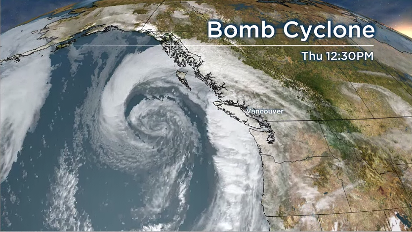
Despite that, wind warnings were in place across Vancouver Island and the Sunshine Coast Thursday as the storm grazed the region.
Category 2 hurricane strength winds up to 161 km/h were reported off the northwest coast of the island, Gordon added.
However, the impact was minimal with only about 600 power outages on the island and about 100 across Lower Mainland.
If British Columbians thought the weather was unseasonably warm as well, they would be right.

Get breaking National news
Gordon said the bomb cyclone caused temperatures to soar to well above seasonal values of 18 to 20 degrees.
“It was almost eerie,” Gordon said. “The reason this occurred was the pressure in the bomb cyclone was so low that it sucks the air towards it, thus causing strong outflow from the interior of B.C. to the coast. As the air descends over the mountains it dries and warms.”
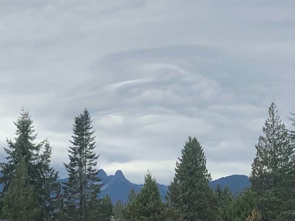
The weather did create some incredible wave clouds though, Gordon added, and they were spotted over the North Shore mountains as the air from the Interior was forced up and over.
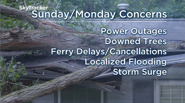
“The second bomb cyclone is set to move onshore Sunday into Monday and is the B.C. coast’s biggest concern.” Gordon explained.
“It has some potential of developing into a ‘double bomb’ before it makes landfall. This means the low pressure system could drop by more than 48 millibars in pressure in less than 24 hours. This is a rapid intensification and will mean damaging winds along the coast.”
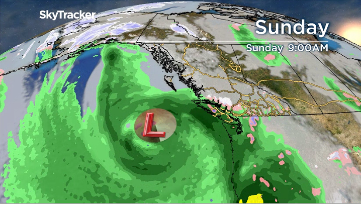


“Keep in mind, this storm is a couple of days out. The intensity and exact track of the low-pressure centre is still uncertain,” Gordon added, noting it will be important for the public to keep tuning in for updates.
“The exact track of low will determine which areas will see the strongest winds. At this time, the low looks like it will cross the northern tip of Vancouver Island” she adds.
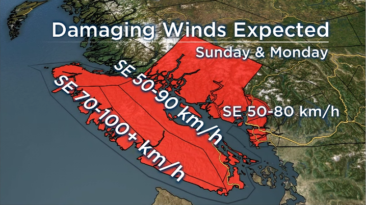
Environment Canada has issued a Special Weather Statement for much of the South Coast.
“A strong rapidly deepening low pressure system from the Pacific will approach west of Vancouver Island on Sunday,” reads the statement.
Southeasterly winds of 70-90 km/h with gusts in excess of 100 km/h are possible across west and north Vancouver Island Sunday morning.
The strong winds will begin to pick up on inner coast Sunday afternoon. Southeasterly winds of 50 to 70 km/h gusting to 90 will occur along east Vancouver Island and will continue Sunday night.
“Some of the strongest winds are possible Monday morning across the coastal regions of the Strait of Georgia, including Greater Victoria, Southern Gulf Islands and Sunshine Coast,” Environment Canada explained.
Western regions of Metro Vancouver and Howe Sound should be bracing for the strongest winds to occur Sunday night through Monday morning. Southeasterly winds of 50 gusting to 80 km/h are possible before they ease Monday afternoon.
Comments
Want to discuss? Please read our Commenting Policy first.