
TORONTO – Once again Environment Canada has issued a special weather statement for the GTA including Toronto.

A low pressure system is set to track across Southern Ontario early Wednesday, once again bringing thunderstorms and the potential of torrential downpours.
The statement said that “the location and coverage of the storms is very uncertain.”
The advisory is in effect for Toronto, York, Durham, Peel, Halton, Windsor, Sarnia, Simcoe, Niagara as well as the rest of Southern Ontario, north to Hunstville and Parry Sound.

Get breaking National news
“The highest probability of thunderstorm activity is actually going to be tonight, overnight,” said Peter Kimbell, warning preparedness meteorologist with Environment Canada. “The good news and bad news is that with an event like that if it did happen overnight, there’d be more rain, yes, but nothing like we had the other day… the storms will move fairly rapidly.”
Kimbell said that, unlike Monday’s storms, the city can expect higher winds.
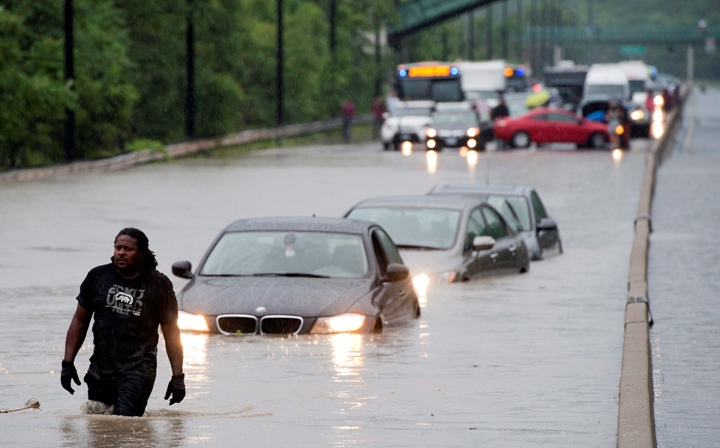
The rain is of particular concern to Toronto after the city was soaked with a record-breaking 126 mm of rain on Monday night (the measurement was taken at Pearson airport in Mississauga). The city continues to recover.
Want your weather on the go? Download Global News’ Skytracker weather apps for iPhone, iPad and Android.
Comments