

It’s hard to believe the May long weekend is coming up when there is snow in parts of southern Manitoba and temperatures are getting cooler than -10 C within a couple days.

Winnipeg set another record-low temperature Monday morning as temperatures dipped to -10.3 C overnight. This is the second time in a week record-low temperatures have been set around southern Manitoba as May 8 saw records set in Winnipeg, Carberry, Pilot Mound, McCreary, Gretna, Steinbach and Fisher Branch.
It has been almost a week since temperatures have been near seasonal in Winnipeg.

The early part of this week will see this below normal weather continue. High pressure sits over central Manitoba, keeping the sky clear and also keeping things cool with a northerly wind.
Monday night will be another cool night where temperatures get close to record lows once again.

Get breaking National news
Tuesday, high pressure will have moved to the southeast, keeping the sky clear and allowing temperatures to warm up slightly.
A change in temperatures will start to come Wednesday as low pressure moves in from the south. Temperatures that day will not be warmer but a warm front with that system will encourage temperatures to warm up as that system passes.
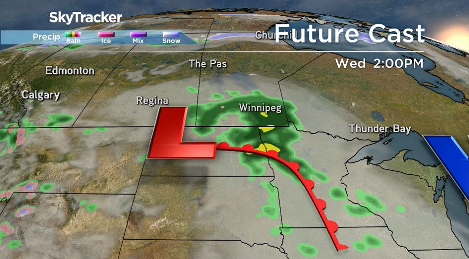


Winnipeg weather models suggest somewhere around 10 to 20mm of rain could be on the way Wednesday, into Wednesday night.
Behind this system, temperatures will start to warm up and return to “normal” for this time of year — just in time for the long weekend.

Comments
Want to discuss? Please read our Commenting Policy first.