A winter wonderland is what higher elevation areas saw form over the weekend and into the first day of October on Monday.

Snow fell at SilverStar, Big White and along the Okanagan Connector as freezing levels fell as low as 1400 metres.
A snowfall warning remained in effect on Monday for Rogers Pass for 25 to 40 centimetres of snow expected by Tuesday afternoon.
Meantime in the valley, light rain dominated the day on Sunday with patches of liquid precipitation lingering into Monday keeping conditions cool, in low double digits into the afternoon.

Get breaking National news
After a few more waves of rain roll through Monday night into Tuesday morning, yet another more organized round of precipitation sweeps in with a low pressure system for the day on Tuesday.

Five to 15 millimetres of rain is expected with freezing levels falling to 900 to 1000 metres late Tuesday into early Wednesday, meaning more high elevation snow is on the way.

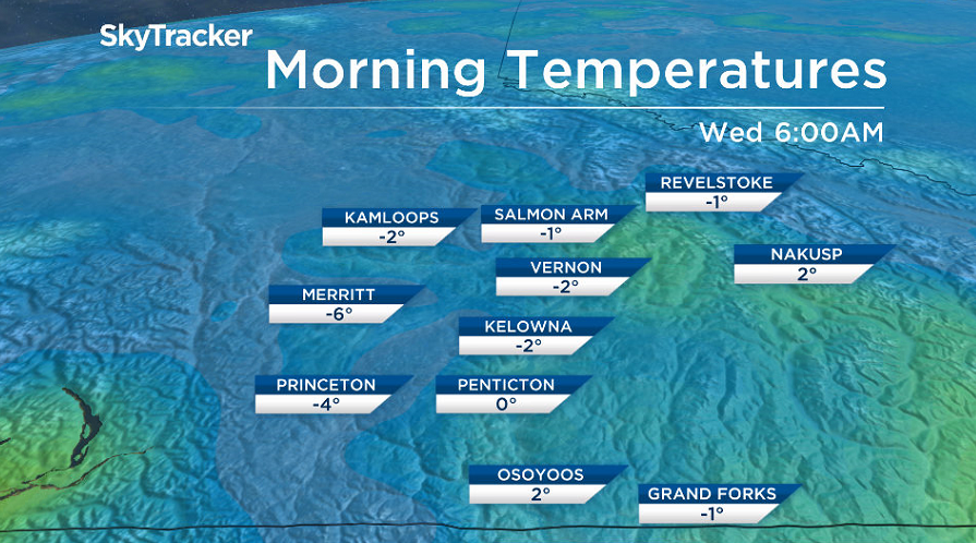
Daytime highs struggle to get into double digits on Tuesday, and as clouds quickly clear out Tuesday night, temperatures will plunge back to their lowest levels seen in nearly half a year.
Frost is likely early Wednesday morning as the mercury falls a degree or so below freezing.
Sunshine will start the day, but clouds will roll in later on as temperatures clamber back into low double digits.
Those clouds will then clear back out on Thursday with an afternoon high settling back into the low teens heading into Thanksgiving long weekend, which is expected to be partly to mostly cloudy with a chance of showers at times.

For weather on the go download the Global News SkyTracker Weather App for iPhone, iPad or Android.


Comments