

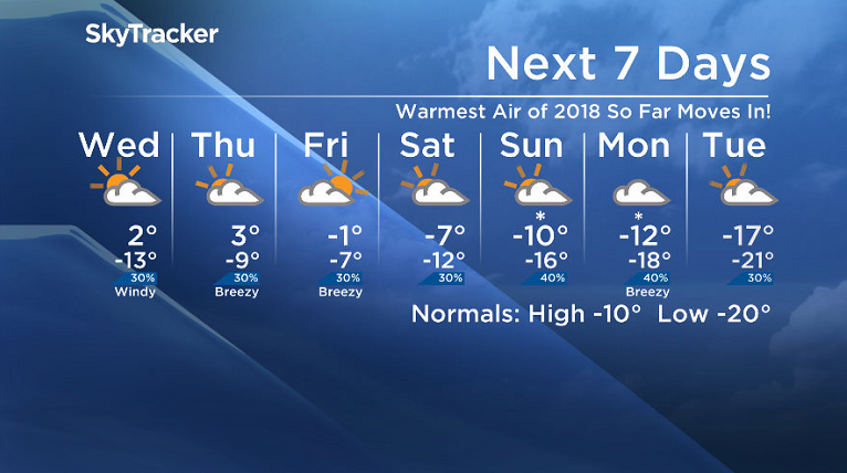
Warmest air so far this year moves in with positive temperatures on the way!

Saskatoon Forecast
Tuesday
After briefly falling into the -20s overnight, Saskatoon warmed up to -19 by morning with wind chills into the -30s at times.
Beautiful blue skies and sunshine started the day with a breezy southerly wind helping warm us up through the mid-minus teens before noon.
Sunny skies stuck around for the rest of the day with the mercury clambering up into minus single digits for the first time in a week as an upper ridge of high pressure built in from the west.
Wednesday
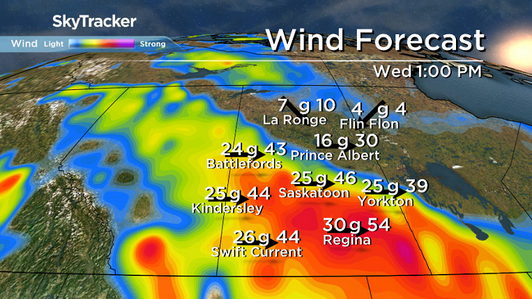
A potent upper disturbance slips through Wednesday that will bring us back into the clouds in the morning and also bring in a risk of a rain/snow mix and possible freezing rain midday.

Skies should clear out later in the day with a breezy westerly wind kicking up into the afternoon gusting upwards of 50 km/h, which will help mix down warm air with a daytime high a degree or two above freezing.
Thursday-Friday
Warm air hangs on for Thursday as we slide into the warm sector of the next system swinging in, which will push temperatures further up, possibly up to 3 degrees above zero in the afternoon under mostly cloudy skies.

As that system slides through on Friday there is a chance of a few flurries, particularly later in the day, with cooler air also dropping in and sweeping our daytime high back below freezing, but just.

Weekend Outlook
Arctic air surges back in with a chance of some snow this weekend under mostly cloudy skies as daytime highs dive back into minus double digits by Sunday.
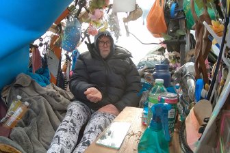
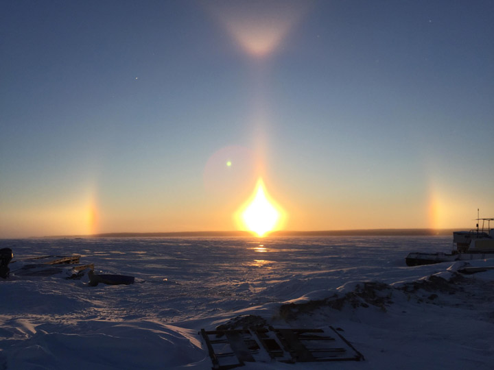
This sun dogs picture for the Jan. 16 Your Saskatchewan photo was taken in Fond du Lac by Dougie Pacquette:
READ MORE: Get a 2018 Your Saskatchewan Calendar today
Saskatoon weather outlook is your source for Saskatoon’s most accurate forecast and is your one stop shop for all things weather for central and northern Saskatchewan with comprehensive, in depth analysis that you can only find here.
- Life in the forest: How Stanley Park’s longest resident survived a changing landscape
- ‘Love at first sight’: Snow leopard at Toronto Zoo pregnant for 1st time
- Carbon rebate labelling in bank deposits fuelling confusion, minister says
- Buzz kill? Gen Z less interested in coffee than older Canadians, survey shows
Comments