
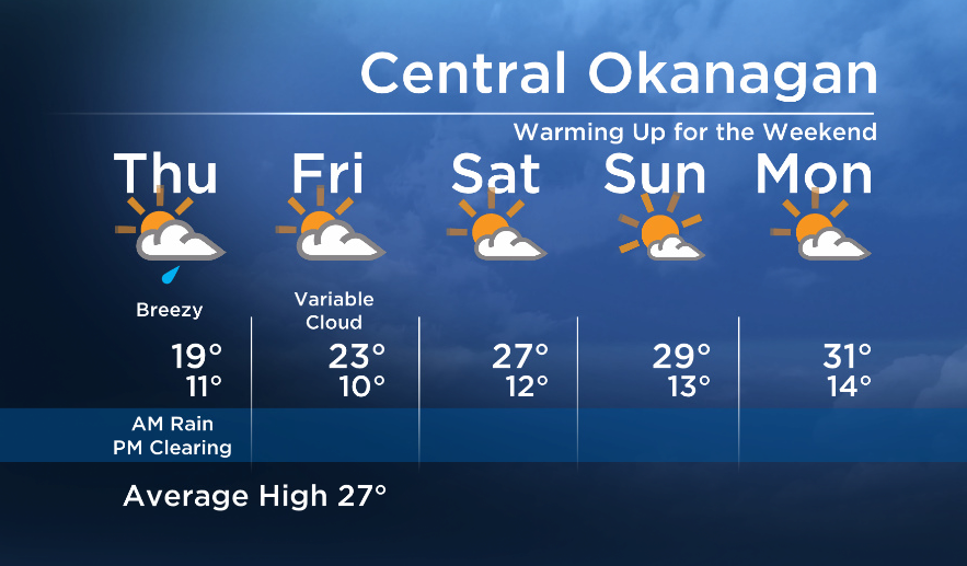
The upper low that was the culprit for Wednesday’s thunderstorms will continue to move east, bringing us a few more showers on Thursday before a much drier weather pattern in store for Friday and the weekend.

Because of the path of the low, the Okanagan will gradually clear first around Thursday midday, but it will take a bit longer the eastern/northern parts of our broadcast region – Arrow Lakes, Boundary, Columbia – to see any significant breaks.


A return to a westerly flow will dry almost all areas in the Southern Interior on Friday, and an upper ridge building in this weekend will warm us up again!
Thursday’s High: 16 to 24C
~Wesla/Duane
- ‘Alarming trend’ of more international students claiming asylum: minister
- TD Bank moves to seize home of Russian-Canadian jailed for smuggling tech to Kremlin
- Why B.C. election could serve as a ‘trial run’ for next federal campaign
- Justin Trudeau headed to UN Summit of the Future amid international instability


Comments