
Here’s a look at the weather on a long weekend when heavy rainfall caused overland flooding and prompted a number of communities to declare states of emergency.

FULL STORY: Deluge prompts Manitoba municipalities to declare states of emergency
The largest rainfall total registered with Environment Canada in Manitoba was 151 millimetres (as of Monday at 7 a.m.), but the whole southwest corner of the province was drenched. The Brandon Municipal Airport registered 127 mm. These are obviously big numbers but to put it in perspective, Brandon typically receives 80 mm of rain over the entire month of June. By the time this system clears, there is potential to add another 20mm to the weekend totals.

Get breaking National news
On the Saskatchewan side of the border, there were unofficial amounts of 200 mm in the Moosomin area and 175 mm near Redvers. The highest official total from Environment Canada came from Broadview, Sask., at 125 mm. Conditions in southeast Saskatchewan are similar to what we’re seeing in southwest Manitoba, with overland flooding, washouts and power outages.
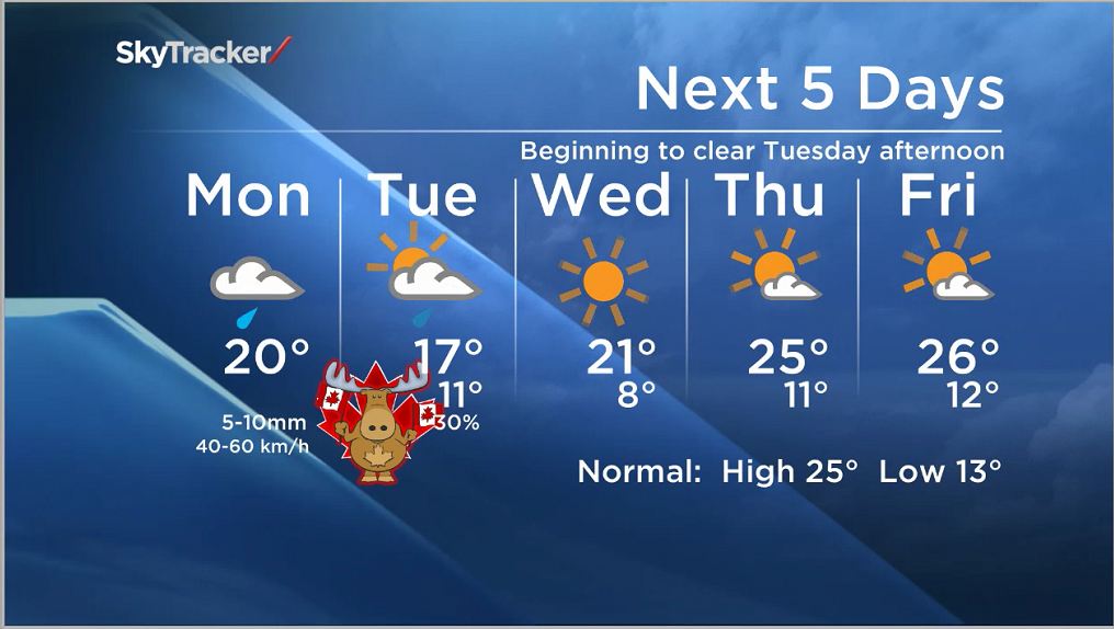
There is still some rain to go. Scattered showers mostly and strong winds will stick around until Tuesday afternoon, just in time for Canada Day celebrations. Firework shows province-wide should be mostly clear but cool. With high pressure working to clear the skies on Canada Day, it will be the coolest day of the week. The rest of the week’s forecasts should begin to dry things out. It won’t be a hot week but we should be back to normal and in the sunshine by Thursday/Friday.


Do you watch the Morning News? Is there a place you would like to see Mike set up live to do the weather? If you have something to show off in your neighbourhood or an event, email mike.koncan@globalnews.ca.
- Michael Kovrig reflects on ‘brutally hard’ Chinese detention: ‘You’re totally alone’
- TD Bank moves to seize home of Russian-Canadian jailed for smuggling tech to Kremlin
- U.S. moves to ban Chinese software, hardware from all vehicles in America
- Conservatives set to table non-confidence motion Tuesday. What to expect


Comments