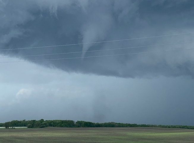
In some parts of Manitoba, Wednesday’s storm was more than just rain.

Environment and Climate Change Canada says it’s looking at reports of tornado touchdowns in Rapid City, Rivers, Swan Lake, Baldur and Cypress River, Man.
Meteorologist Dan Fulton told 680 CJOB that it looks like there were three or four separate tornadoes in the province, but they could end up finding more, as it will take a few days to confirm via satellite imaging.
If officially confirmed, these would be the first tornadoes of the year for the province, which sees an average of nine annually.

Get daily National news
“They have to look for damage,” Fulton said.
“That’s the thing with tornadoes — you can’t really tell how strong they are unless they hit something that they can wreck, and a lot of these were over farmers’ fields.”
Fulton said the weather conditions need to be just right to produce a tornado, and Wednesday’s storm checked all the boxes.
“It doesn’t have to be super hot at the ground, as long as it’s colder aloft, because then you’ve got your warm air rising, and very rapidly rising updrafts will contribute to tornadoes,” he said.
- Old Man Winter wallops B.C.’s Mainland/Southwest region, major highway closed
- Calgary hit by unexpected blast of spring snow, causing dozens of crashes
- False spring strikes again: Saskatchewan prepares for incoming winter weather
- Albertans’ interest in alternative forms of travel growing as fuel prices spike
“The other thing you need is the winds — the winds have to change from an easterly or southeasterly direction to more of a westerly. It’s called wind shear.”
There were also reports of golf ball-size hail in the Morden-Winkler area, as well as structure damage.


Comments
Want to discuss? Please read our Commenting Policy first.