Standing on the banks of the South Saskatchewan River, near the Whitecap Dakota First Nation, presents a view of an endless river and a valley on either side.

It’s one of the spots on the Trans Canada Trail that trail development manager Kristen Gabora says can leave visitors in awe.
“We opened the Chief Whitecap Waterway at Whitecap Dakota First Nation, and when you’re standing on that riverbank and you’re looking out, it’s just the most beautiful, beautiful thing ever,” Gabora said.
“The whole waterway is phenomenal.”
READ MORE: Northern Saskatchewan journey a chance to discover myth of Grey Owl
The Chief Whitecap Waterway is the Trans Canada Trail’s first paddling route in Saskatchewan.
It’s just over 100 kilometres of water trail, running through the Whitecap Dakota First Nation from the Gardiner Dam on Lake Diefenbaker to the city of Saskatoon.

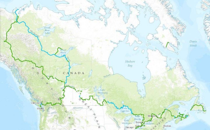
The waterway is part of about 1,700 kilometres of the Trans Canada Trail in Saskatchewan. The trail is connected through walking paths, waterways and on gravel country roads.
The idea of creating a trail that would link Canadians from coast to coast started in 1992. Since then, Trans Canada Trail, a not-for-profit organization, has been working with donors, governments and volunteers to create an epic trail on both land and water routes.
“The trail really is a living symbol of national collaboration, one that will continue to grow and flourish for generations to come,” said Trans Canada Trail president and CEO Deborah Apps.
READ MORE: Lake, hikes and history draw visitors to Saskatchewan Landing Provincial Park
There are about 20,770 kilometres of trail across Canada so far and it’s 87 per cent connected. Saskatchewan’s section was announced as fully connected Oct. 1.
Some 40 rural municipalities in Saskatchewan got on board with the project and chose routes that link people to points of interest. They intentionally stayed off highways.
“We really wanted to keep people all about what Saskatchewan is and it’s not about following a ribbon of highway,” Gabora said.
“It’s about following grid roads, which are like following the roads of the pioneers.”
Standing on that dusty road that stretches forever, with farmland on either side, makes you wonder what the first settlers thought when they stood here, said Gabora. It must have been intimidating and inspiring at the same time.
“Everywhere you go on this trail, I think you get that feeling,” Gabora said.
“You get the rich history of Saskatchewan. You get the feeling of our settlers. You get the feeling of our First Nations. This whole province is just so etched in history and I think, at times, we tend to forget that. And I think on this trail it gives you a chance to get back to those roots and to really feel one with nature.”
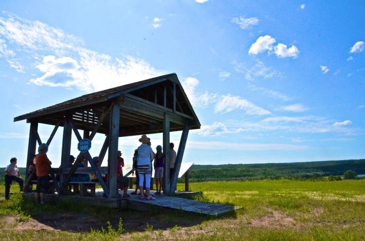
Work is also finishing up on a six-kilometre part of the Elbow Trail, running between the golf course in the village of Elbow and Lake Diefenbaker.
Gabora said it will be a must-see spot.
“It’s very quiet. It’s peaceful,” she said.
“At times, you’re up on an open hill, on an open prairie hill overlooking the lake (with) this beautiful vista. Then you come around a corner and you’re in dense, dense trees and brush and you feel like you’re in the middle of a forest. It’s just unbelievable. There are so many different aspects to this trail.”
“It’s not overly long, but it’s beautiful, and it is a major link between Douglas Provincial Park and Danielson Provincial Park.”
READ MORE: Campers rejoice as Sask. campgrounds celebrate 10 year anniversary of alcohol ban
The Trans Canada Trail website lists five must-see sections of the trail in Saskatchewan, including a bicycle-friendly stretch along the Louis Riel Trail that leads cyclists to the National Historic Site at Batoche, Riel’s headquarters and the site of the last battle of the North-West Rebellion of 1885.
Gabora said Batoche is her favourite historical spot on the trail.
She also likes the sunset from the Saw-Whet Trail near Lumsden, just north of Regina, and says the Wakamow Valley Suspension Bridge in Moose Jaw is the “icing on the cake” for a trail with kids.
But it’s hard to choose an overall favourite spot.
“I have been probably on every section of this trail and they are all so unique and they all pull at my heartstrings for different reasons,” Gabora said.
Comments