

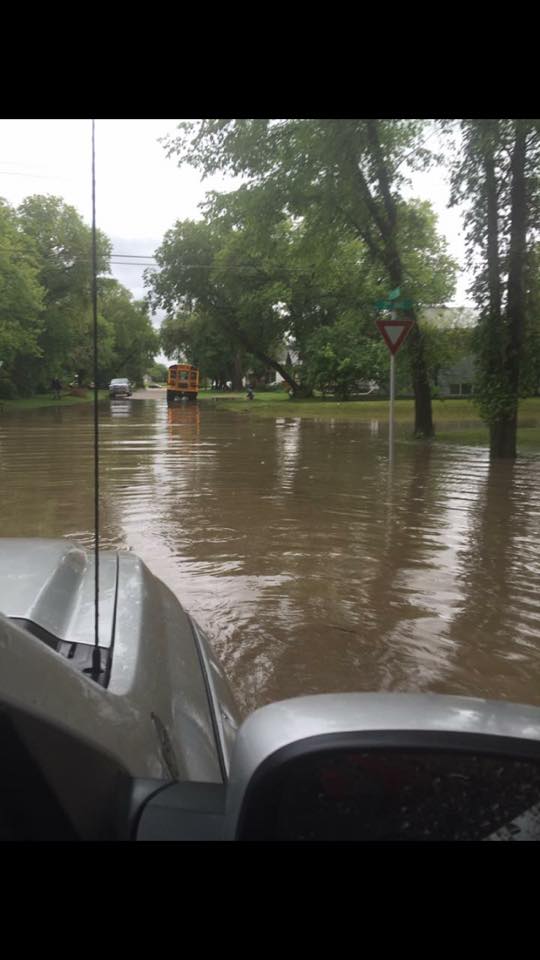
Heavy rains associated with a low pressure system swinging through over the weekend resulted in flooding in portions of eastern Saskatchewan.

A state of emergency was declared in Elfros with the closure of Highway 16 and the stopping of a train due to wash-out fears caused by heavy water flows. The highway has since reopened.

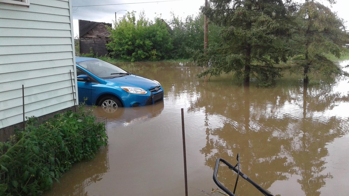


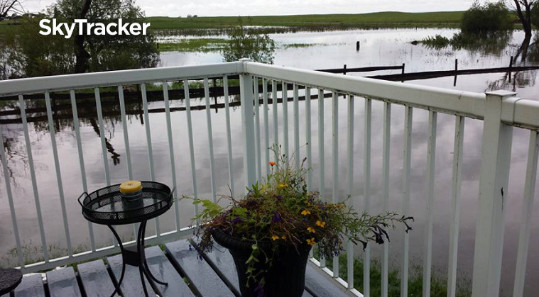

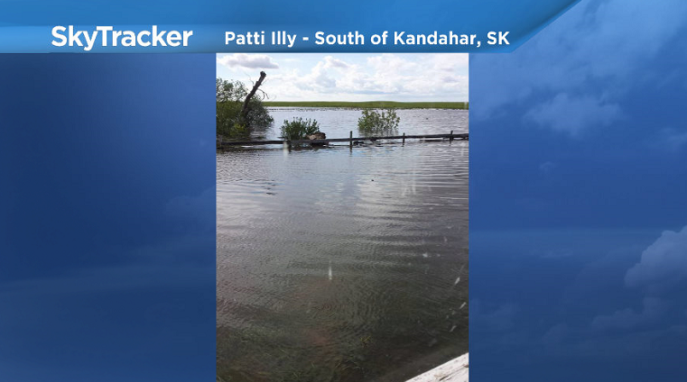

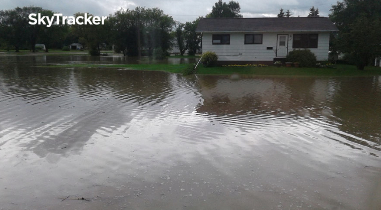
There are reports of people being evacuated from their homes south of Big Quill Lake in the Kandahar area.
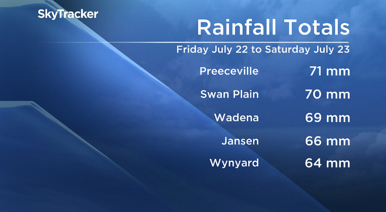
Environment Canada reported 69 millimetres of rain in Wadena from Friday through Saturday, noting that the region has already been waterlogged by recent rains; however the Wadena Fire Department reported that 4 to 6 inches (approximately 100 to 150 millimetres) fell in the area.
Saskatoon Forecast
Today
The day started out around 14 degrees under mostly cloudy skies with a few light sprinkles as a cold front passed by the area.
Clouds then started to clear out to mostly sunny by mid-morning with temperatures quickly jumping up into the mid-20s as well, feeling around 27 degrees with humidity by noon.
Mostly sunny skies are expected to stick around through the remainder of the day with the mercury continuing to climb up to around 27 degrees, feeling around 30 with humidity.
Tonight
Mostly clear skies are expected to continue tonight as temperatures drop back to around 12 degrees.
Tuesday


An upper disturbance moving through tomorrow will keep the city under mostly cloudy skies through the day with a slight chance of midday showers.
As a result, temperatures will likely be a bit cooler with an expected high back into the mid-20s.
Wednesday-Friday
The sunshine looks to make more of a return for Wednesday before clouds return on Thursday with a chance of late day showers and thunderstorms.
Daytime highs are expected to sit around 27 or 28 degrees both days before warming up even further to around 29 for Friday under a mix of sun and cloud and a chance of thundershowers.
Weekend Outlook
The weekend could be hot, humid and possibly quite stormy as a low pressure system build in the clouds on Saturday with the associated cold front potentially sliding through then on Sunday.
The timing of this system swinging through likely won’t become more certain until later this week, but at this point it appears that temperatures could be topping out close to or into the 30s both days.
Debbie took this Your Saskatchewan photo of the North Saskatchewan River high above the Borden Bridge:

Saskatoon weather outlook is your one stop shop for all things weather for Saskatoon, central and northern Saskatchewan with a comprehensive, detailed look at your local forecast that you can only find here.
Comments