
WINNIPEG — Southern Manitoba was put under a severe thunderstorm watch by Environment Canada before noon Monday.

Hot and humid conditions created the perfect combination for storms to pop up, and they did however it took until late Monday afternoon before the area really saw any action.
Stormy conditions started in the southwest and continued to move eastwards.
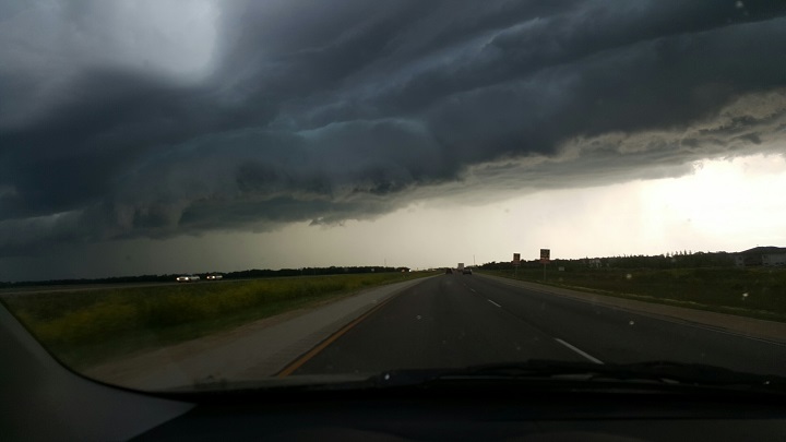
A line of thunderstorms moved through the province producing high winds, heavy rain and various sizes of hail.
Storm spotters reported golf-ball-sized hail falling in Deloraine as high winds were also reported in both the Gretna and Deerwood areas, with wind-speeds reaching over 90 km/h.
Spotters also reported strong winds near Headingley near 80 km/h.
Pictures were seen on Twitter of funnel clouds spotted outside of Winnipeg but at the time of this post, none were confirmed to have touched down. There were also no tornado warnings issued by Environment Canada.


Storm images captured by some on Twitter:
By 7:30 p.m., all warnings had been lifted for the city after being under severe thunderstorm warnings for about 90 minutes.
The weather outlook for Tuesday may produce some unstable weather once again.
The forecast calls for a high of 25 C with increasing cloud and a decent chance of showers or thunderstorms by the afternoon.
- Budget 2024 failed to spark ‘political reboot’ for Liberals, polling suggests
- Train goes up in flames while rolling through London, Ont. Here’s what we know
- Peel police chief met Sri Lankan officer a court says ‘participated’ in torture
- Wrong remains sent to ‘exhausted’ Canadian family after death on Cuba vacation
Comments