

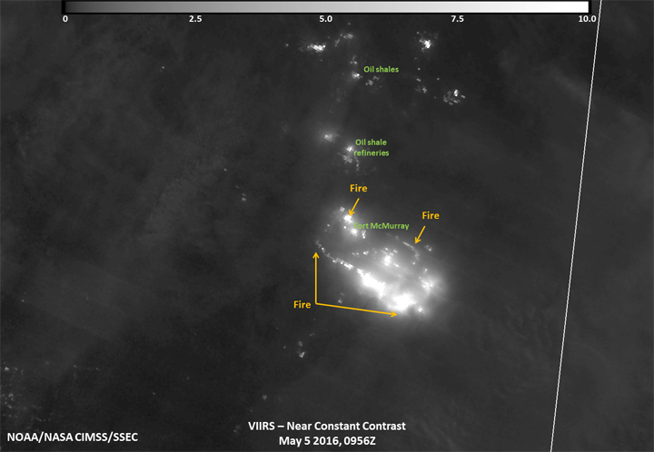
The devastating wildfires that forced more than 88,000 people from their homes in Fort McMurray has been imaged from space.

A satellite operated by NASA and the National Oceanic and Atmospheric Administration (NOAA), captured the raging forest fires surrounding Fort McMurray.
READ MORE: Climate change: Does a warming climate mean more wildfires?
The Suomi National Polar-orbiting Partnership (S-NPP) satellite has an extremely sensitive camera that images in the infrared. The camera, called the Visible Infrared Imaging Radiometer Suite (VIIRS) took a nighttime image of the fires surrounding Fort McMurray early Thursday morning. (For a high-resolution image, click here.)

In the image, the fires are the brightest parts, while the light grey represents the smoke from the fires.
The high winds, which appear to be blowing south-southeast of the blaze, exacerbated the fire on Tuesday and Wednesday forcing the city to issue a mandatory evacuation order.
Comments