Scientists warn that the area covered by this winter’s Arctic sea ice could turn out to be the lowest ever measured.

The news comes on top of a long season of freakishly warm weather at the top of the planet, including above-freezing days at the North Pole and a months-long string of temperature records.
“The winter, overall, has been extremely warm in the Arctic,” said Ted Scambos, a glaciologist at the National Snow and Ice Data Centre in Colorado.
Scambos said the ice season still has a week or so to go and a sudden frosty surge could bring ice levels above the previous record low, set last year.
READ MORE: Revamped satellite data shows no pause in global warming
“It would not be surprising at all to have a late growth.”
But most years, the sea ice maximum has already been reached by this point.
“(Sea ice) has been quite low,” Scambos said. “Most of the days in February were records for that day.”
Sea ice extent is now slightly under the previous satellite-era record low maximum of 14.54 million square kilometres. Most of the ice loss has occurred north of Siberia.
- High benzene levels detected near Ontario First Nation for weeks, residents report sickness
- Meta says you can’t turn off its new AI tool on Facebook, Instagram
- Enter at your own risk: New home security camera aims paintballs at intruders
- Beijing orders Apple to pull WhatsApp, Threads from its China app store
Canadian waters such as Baffin Bay and the Labrador Sea are about average or slightly above it for sea ice. The Gulf of St. Lawrence, which is included in the centre’s estimations, is largely ice-free.
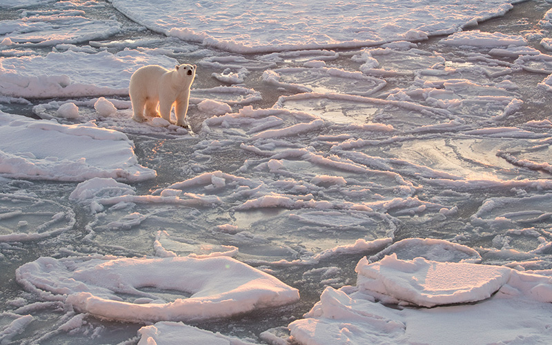
Arctic sea ice is a crucial part of the northern ecosystem, relied on by organisms from algae to polar bears.
But it’s also a significant factor on weather for the rest of the planet. An ice-free Arctic has already been linked by some studies to multi-day rains or storms in more southerly latitudes.
And so far, there’s been less of it around this winter than ever before.
February’s average ice cover was the lowest since satellite records began. So was January’s.
And the nine months between May 2015 and January 2016 saw the highest values for average global temperatures ever seen. January’s temperature was above normal by the highest margin of any month on record.
“Right at the turn of the year there was a very unusual warm event in which you had these atmospheric rivers that basically piped warm air from the Azores right to the Barents and Kara Sea and even to the North Pole, where you had above-freezing conditions for a day or so,” Scambos said.


“Even a station near the North Pole briefly recorded above-zero conditions, which are very unusual, if not unprecedented.”
Although an unusually strong El Nino created warm winters in many areas this year, Scambos said that weather system didn’t have much to do with the balmy Arctic.
“If there’s a relationship, it’s fairly tenuous,” Scambos said.
“Past El Ninos have not had this kind of an impact on the Arctic. The fact we’re surpassing the record by fairly significant amounts in January and February has to do with the profound Arctic warming that we’re seeing in addition to the El Nino pattern.”
It’s not clear, however, what impact the low winter coverage will have on the coming summer. Low winter maximums are not always followed by equally low summer minimums and much depends on what happens in June, said Scambos.
Arctic sea ice has been declining at the rate of about 12 per cent per decade since satellite monitoring began in the late 1970s.
The Arctic has been warming at about twice the rate of the rest of the globe and is now about four degrees warmer than it was before climate change.
Comments