
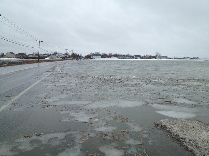
VAUDREUIL, Que. – Rising waters caused by rainfall and snow thaw have caused flooding in the village of St-Clet in Vaudreuil-Soulanges.

According to reports, almost a metre of water has accumulated, and authorities will closely monitor the rising water levels over the next few hours.
Roads into the area have been closed, in particular the junction at the north-south route 201, known as rue Principale, and the east-west route 340, known as Boulevard de la Cité des Jeunes.
The last time the village, home to some 1,738 residents, was affected by significant high water levels was in March 1985, when heavy rains caused flooding, forcing the evacuation of several homes.


Flood concerns growing in Quebec
The spring thaw means rising water levels across the province.
Flood watches have been issued, with flooding already noted in the Laurentians, Outaouais, Lanaudière, Québec and Mauricie regions.
“Milder temperatures and rainfall could result in low to moderate increases in river watersheds,” noted a warning issued by Hydro Météo, a private company that specializes in flood forecasting.
Rivers to watch
There are 27 rivers currently on the Hydro Météo watch list as of April 8, 2014:
1. Rivière de la Tortue
2. Rivières Châteauguay, Des Anglais, Aux Outardes, Truite
3. Rivières Richelieu, l’Acadie, Aux Brochets, des Hurons
4. Rivière Yamaska, Noire
5. Rivières St-François, Eaton, Aux Saumons, Coaticook
6. Rivières Nicolet, Bullstrode, Nicolet Sud-Ouest
7. Rivière Bécancour
8. Rivières Chaudière, Famine, Beaurivage
9. Rivière Etchemin
10. Rivière du Sud
11. Rivière du Lièvre
12. Rivière Petite Nation
13. Rivières Rouge
14. Rivière du Nord
15. Rivières L’Assomption, Noire, Ouareau, l’Achigan
16. Rivière Bayonne
17. Rivières Mastigouche, Maskinongé
18. Rivière du Loup
19. Rivière St-Maurice, Matawin
20. Rivières Batiscan
21. Rivière Sainte-Anne, Bras du Nord
22. Rivière Portneuf
23. Rivière Jacques Cartier
24. Rivière St-Charles, Nelson, Lorette, Du Berger
25. Rivière Montmorency
26. Rivière Sainte-Anne
27. Rivière du Gouffre

Comments