
Weather warnings, from wind along the South Coast to snow and wind in the Interior and northeast, are in effect for much of B.C.

On Saturday, Environment Canada issued the alerts, saying an intense Pacific cold front will sweep across the Interior from north to south late Saturday and into the night.
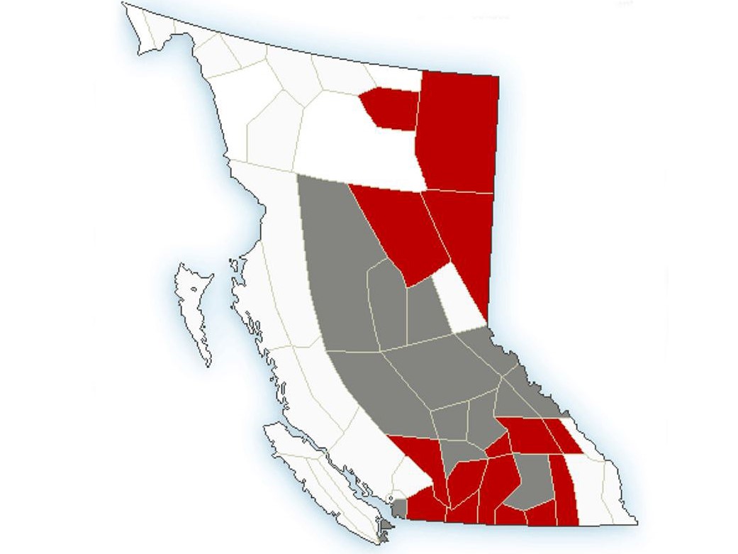
The alerts stretch from the Lower Mainland to the Okanagan and northward to the Peace River and Fort Nelson regions, with Environment Canada calling for varying amounts of snow in the Interior.
Winter storm warnings are in effect for mountain passes, where up to 25 cm is projected, while special weather statements were issued for lower areas, where lower snowfall totals are in the forecast.
The snow is expected to end early Sunday, when the frontal system exits the province.
“A band of heavy snow and strong northwest winds associated with the front will cause poor visibility for about two or three hours. Many areas will see five cm of snowfall while higher elevations could see as much as 10 cm.”

The national weather agency says the cold front is projected to cross Prince George early Saturday evening, 100 Mile House and Blue River later in the night, then Revelstoke and the southwest Interior near midnight. Lastly, it will reach the Kootenays after midnight.
Regarding mountain passes, Environment Canada says to consider postponing non-essential travel until conditions improve, as roads may be difficult to navigate and visibility may be reduced to near zero at times.

Mountain passes

Get breaking National news
Coquihalla Highway (Hope to Merritt)
- Hazardous winter conditions expected with heavy and blowing snow. 25 cm projected.
Okanagan Connector
- Hazardous winter conditions expected. Heaviest snow after midnight, with up to 15 cm forecast. Wins of 60 km/h.
Trans-Canada Highway (Eagle Pass to Rogers Pass)
- Hazardous winter conditions expected with heavy and blowing snow. 25 cm projected.
Highway 3 (Hope to Princeton, Paulson Summit to Kootenay Pass)
- Hazardous winter conditions expected with heavy and blowing snow. 25 cm projected.
Highway 97 (Pine Pass)
- Heavy snow and reduced visibilities in blowing snow. 10-20 cm of snow, winds of 30 to 50 km/h.

For the northern half of the province, cold weather is expected once the snow ends.
“As the weather system departs, Arctic air will begin to flood into the region, bringing plummeting temperatures and flurries,” said Environment Canada.
“Snowfall accumulations on Sunday will only amount to a few centimetres, but is favoured to fall on Highway 97 east of Pine Pass.”


Officials remind motorists to be prepared for winter driving, and that the driving public should have emergency supplies with them when travelling, such as an emergency kit with drinking water, food, medicine, a first-aid kit and a flashlight.
The forecast next week for northern B.C. will see temperatures on Sunday go from a high of -2 C to an overnight low of -13 C. And from there, they steadily drop, with Wednesday seeing a high of around -20 C and an overnight low of around -30 C.

For the Lower Mainland, Victoria and southern Gulf Islands, temperatures won’t be anywhere near as cold, though strong winds are projected. Saturday’s high will be around 9 C and drop overnight to 2 C, along with steady rain.
“An intense Pacific cold front will sweep across the South Coast tonight,” said Environment Canada. “The strongest winds will be the pre-frontal south or southwesterlies this evening except late this evening and after midnight for Chilliwack and Hope.
“The winds are strong enough to cause some power outages over the region. The highest gusts of 80 km/h are expected to occur near the water and near Hope.”
The winds are projected to ease overnight.
Sunday will see a 40 per cent chance of showers under a mix of sun and cloud, along with a high of 7 C. Monday’s forecast will see a high of 6 C under a mix of sun and cloud and a 40 per cent chance of rain or snow overnight, as temperatures fall to 1 C.
However, periods of snow are possible Tuesday through Friday, with highs around 5 C and overnight lows dropping below freezing.

Comments