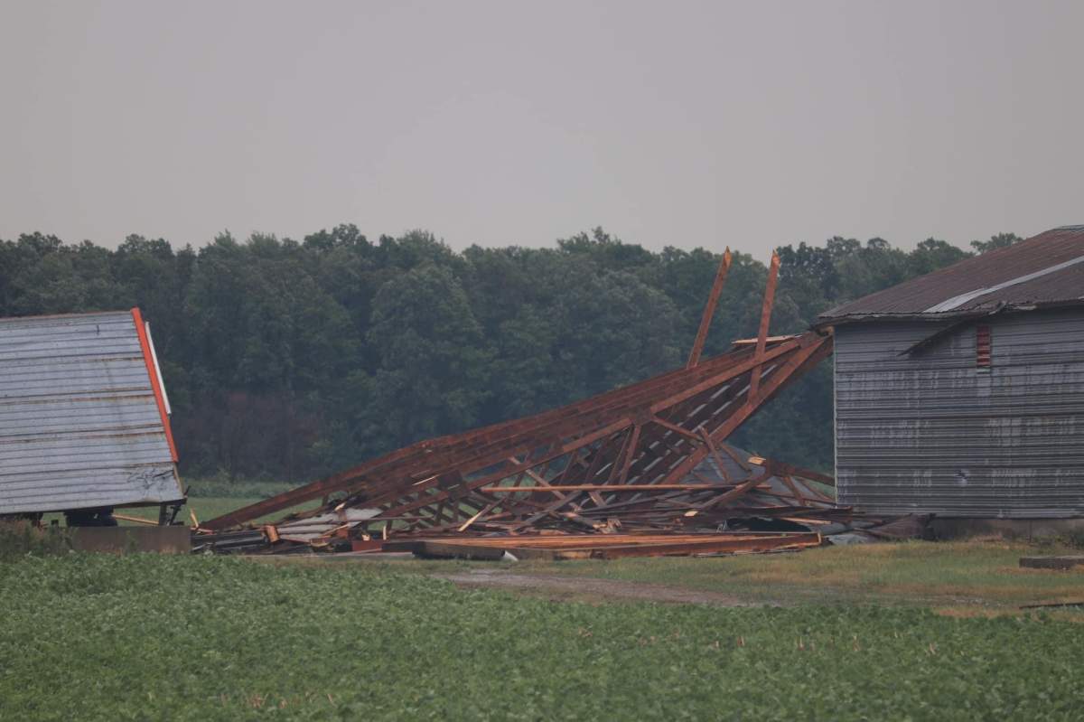
A heavy wind and thunderstorm rocked through southwestern Ontario on Wednesday, leaving extensive damage in its wake.

Thursday, a team from the Northern Tornadoes Project (NTP) at Western University in London, Ont., was dispatched to examine the damage and determine whether a tornado hit the ground.
Speaking on London Live with Mike Stubbs, executive director of NTP said sifting through the damage and the data is complicated.
“We’re trying to put all of this together, trying to figure out exactly what happened,” Sills said.
He described the damage as a “lower end EF1” on the Enhanced Fujita or EF scale of tornado damage.
“We had several barns and outbuildings that were damaged or destroyed, a few homes with shingle damage, trees uprooted and snapped.”
Sills said connecting the dots and determining if a tornado caused damage tends to take a bit of time.

Get breaking National news
“Someone said they saw a tornado, actually it was more like an almost tornado, and they weren’t sure if it was actually doing any damage at ground level. But we know there was damage in the vicinity. We could see on the radar that there was this big burst of wind that was on the south side. Some of these events get pretty complicated and we collect as much data as we can.”
From here, Sills said the next step is to look at high-resolution satellite imagery. He added this can help get a bigger picture of the area. Putting that with the data researchers collect from the ground can help make more sense of it.
The tornado siren at Western University could be heard on Wednesday, alerting people in the area. But there are a few things that go into a siren alarm.
“There was a tornado watch issued first. And that’s because the conditions were looking pretty good for a line of tornadic storms to come through. Once they started crossing the lake and getting into our area, there were areas of rotation on radar. That’s what prompted the tornado warnings and that’s great because you want people to have lead time before the tornado gets to them.”
Luckily, there was one missing ingredient in the recipe for a tornado.
“There was an upper low-pressure system that came from Alberta and just slowly drifted right across to us. It just started losing a bit of oomph — upper dynamics we call it — the things that really cause the storm to have strong updrafts and then generate tornadoes. That was just starting to weaken as it got into our area.”
Chris Godwin was in the area of Thedford when the storm hit.
“I came upon the storm between Ipperwash and Highland Glenn,” Godwin said.
“At that point, I was only dealing with 50-60 km/h winds. I moved up about half a mile and ended up putting myself directly in the path of the storm. I wound up in the middle and at one point I had zero visibility and the winds were easily 100 km/h plus.”
Godwin said he waited about 10 minutes for the storm to pass. When he continued to drive, he found a lot of damage.
“Large trees were snapped in half and a number of barns damaged, with a few smaller ones destroyed,” he said. “There was also quite a large amount of crop damage.”
The Northern Tornadoes Project team will continue investigating to determine if a tornado touched down.


Comments