
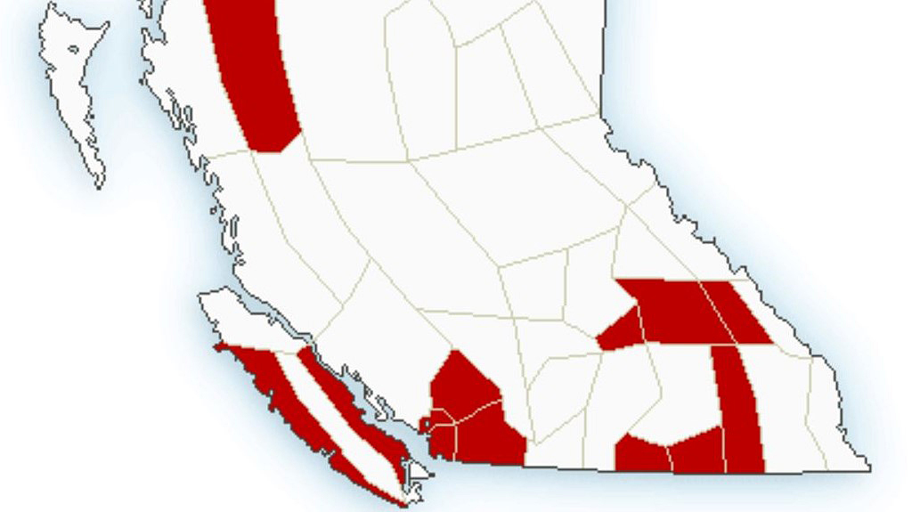
Winter storm warnings have been issued for mountain highways in southeast B.C.

Issued by Environment Canada on Saturday just before 4 a.m., the warnings include the Shuswap, Boundary, West Kootenay, Kootenay Lake plus the West and East Columbia regions.
For the Trans-Canada Highway, the winter storm warning goes from Eagle Pass to Rogers Pass. For Highway 3, it’s from Paulson Summit to Kootenay Pass. Hazardous conditions are expected along both routes.
The national weather agency says Rogers Pass will see near 35 centimetres of snow by early Sunday morning.

Get breaking National news
For Highway 3, there’s even more snow en route, with Environment Canada projecting up to 45 cm for Kootenay Pass and Blueberry-Paulson Summit.


Environment Canada has also issued rainfall warnings for Vancouver Island and the Lower Mainland.
For Vancouver Island, the approach of another moist Pacific frontal system is expected to bring 50 mm. The heavy rain is expected to end by Saturday night as it moves inland.
For Whistler and Metro Vancouver, totals of 40 to 50 mm are expected, with the Fraser Valley seeing 60 mm, along with possible localized flooding in low-lying areas.
Though heavy rain is projected for those areas, inland sections of the North Coast could see 25-30 cm of snow.
Motorists are reminded that if visibility becomes reduced while driving to turn on their vehicle’s lights. Leaving a vehicle in its automatic daytime running mode may not activate the tail-lights.

Comments
Want to discuss? Please read our Commenting Policy first.