


This story has been continuously updated to reflect all evacuation orders and alerts in the area.

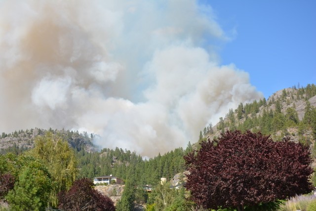
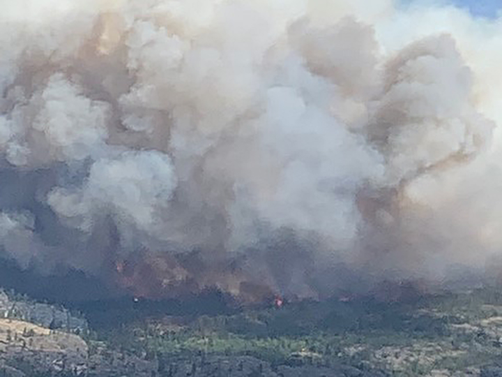
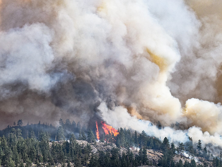
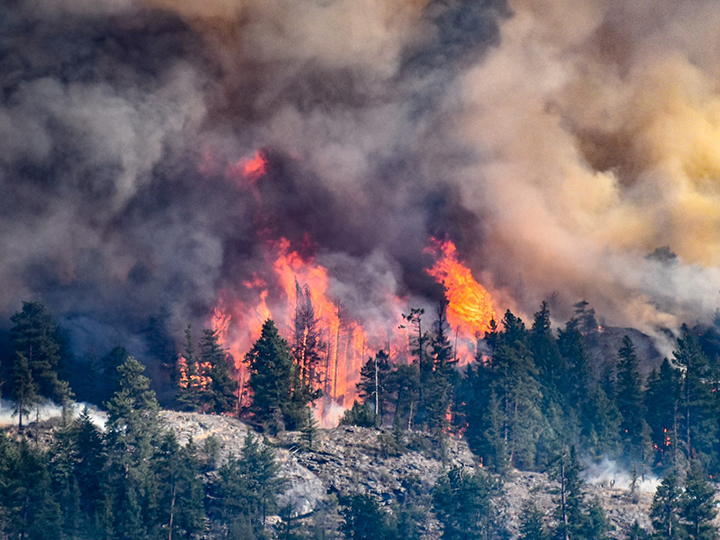
Massive plumes of smoke are rising from the Mount Christie wildfire in the South Okanagan, threatening thousands of properties in the area.
The fire is on the east side of Skaha Lake, between Penticton and Okanagan Falls.
The BC Wildfire Service says the fire at last estimation is 1,000 hectares in size, and is located around six kilometres north of Okanagan Falls.
Approximately two hours after the fire first became visible, it was estimated to be 10 hectares in size. But at 6 p.m., BC Wildfire increased that to 250 hectares, adding it had zero per cent containment.
Later the same evening, the fire’s size estimate was bumped up to 500 hectares, then 1,000 hectares.
“We did a track not too far back Tuesday evening,” said BC Wildfire Service Information Officer Nicole Bonnett. “I expect that this size will change a little bit again, and as visibility gets better, we’ll be able to adjust that size tracking to more accurately reflect the perimeter of the fire. But we are still in the first 24 hours of the incident. So it is still a new incident and growth can be anticipated.”
Bonnett tells Global News fire crews remain on scene overnight.
“We have 21 personnel onsite tonight; firefighters that are working to build some control lines. And we also have structure protection that’s out there throughout the evening as well. Air tankers are currently grounded, just due to the fact that it’s nighttime.”
Bonnett says warm and dry conditions are not helping matters in the curbing the wildfire’s growth overnight.
“It is still fairly warm out there this (Tuesday) evening,” said Bonnett. “And so when we have warmer weather in the night, it means that the overnight recoveries aren’t quite as great. Whenever there’s a cooler, damper evening that obviously minimizes fire activity and fire behavior, and goes a long way towards helping the crews. But when it stays warmer and dryer like this throughout the night, it means that the fire activity is going to be a little bit more visible and a little bit more active throughout the evening.”
The fire is said to be burning along difficult, rocky and sloped terrain, with limited access points for firefighters.
BC Wildfire also said the fire is under investigation.
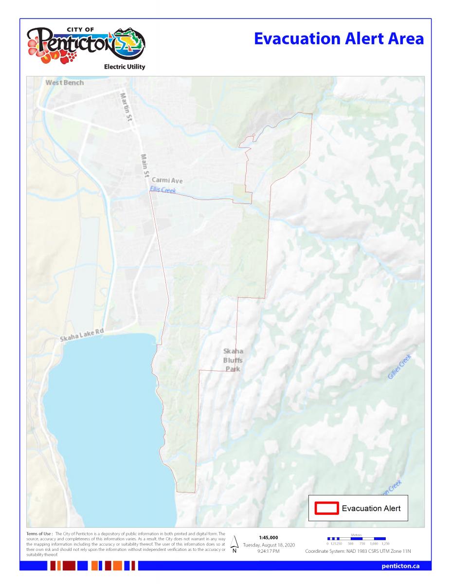
Shortly after the fire broke out, the Regional District of Okanagan Similkameen issued an evacuation order for 319 properties in the area.
The evacuation order can be downloaded here.

Get daily National news
A further 116 properties in the Upper Carmi area and an additional home north of Heritage Hills are now under an evacuation alert, the RDOS said late Tuesday. Skaha Bluffs Provincial Park is also under an evacuation alert.
That order can be found below:
The City of Penticton also issued an evacuation alert for 3,669 properties in the city’s southeast. That order can be read in full here.

Earlier Tuesday, the city activated its emergency operations centre in response to the wildfire.

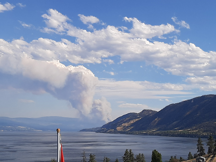
A view of the fire from Peachland.
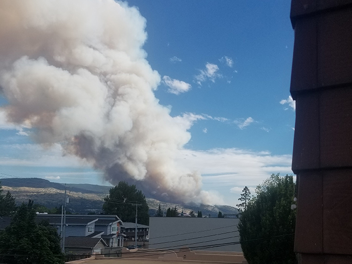
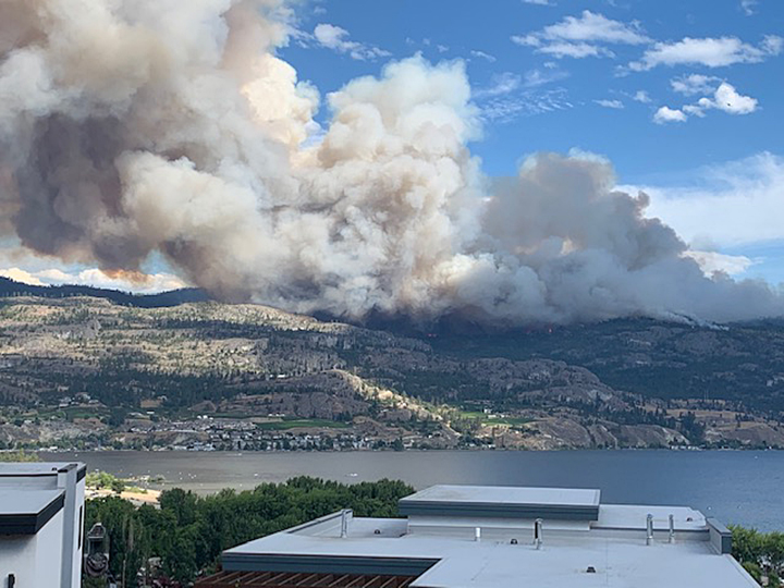
Billowing smoke from the Mount Christie wildfire in the South Okanagan.
3 fires burning near Beaverdell
In related news, three fires are burning near Beaverdell on Highway 33.
As the crow flies, Beaverdell is approximately 35 km due east of Penticton, but is a 90-minute drive along a forest service road.
The fires are new, but two are located opposite of each other along Highway 33, approximately four km north of Beaverdell.
The biggest fire is the Solomon Mountain fire, estimated at 17.5 hectares.
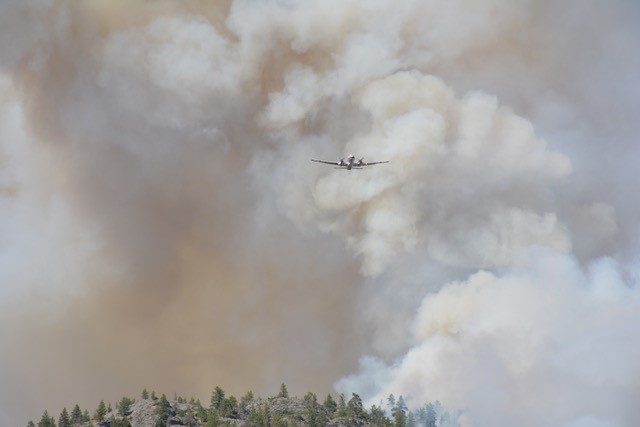
A cameraman for Global News was on scene, and said crews were actioning the fires with helicopters and planes.
Winds are gusting and trees are candling. It’s currently unknown if any structures are being threatened.
An evacuation alert, issued for the Regional District of Kootenay Boundary, is in place.
Fire burning south of Osoyoos
Continuing on with wildfires, the Washington State Dept. of Natural Resources says a 100-acre fire (40 hectares) is burning in Okanagan County, not far from the border.
It says the Palmer Fire in Okanogan County is mostly comprised of grass and brush plus timber, and that resources are on scene.
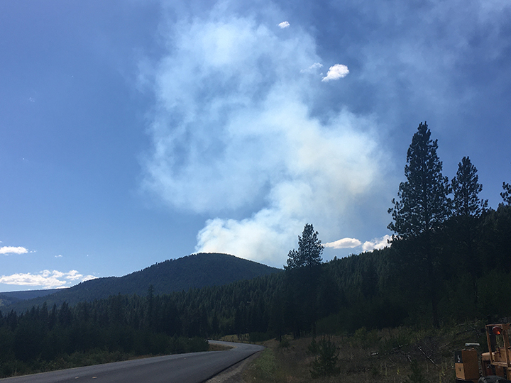
Smoke from the fire can be seen in Osoyoos.
To view the Palmer fire, click here.
Comments
Want to discuss? Please read our Commenting Policy first.