
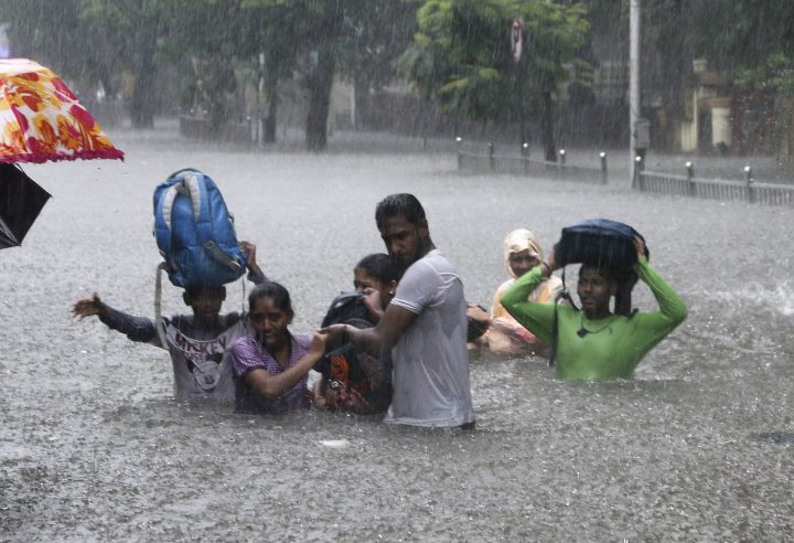
There are more people living in vulnerable coastal areas at risk of rising sea levels than initially thought, according to new research published earlier this week.

“More than three times as many people as we thought are living on the land that is vulnerable this century to sea level rise and coastal flooding,” study co-author and chief executive of Climate Central Benjamin Strauss said in an interview on Tuesday.
The study found that approximately 300 million people around the world live on land that will likely experience at least one flood each year by 2050, Strauss said.
A previous estimate using older data had pegged this figure at around 80 million people.
Results
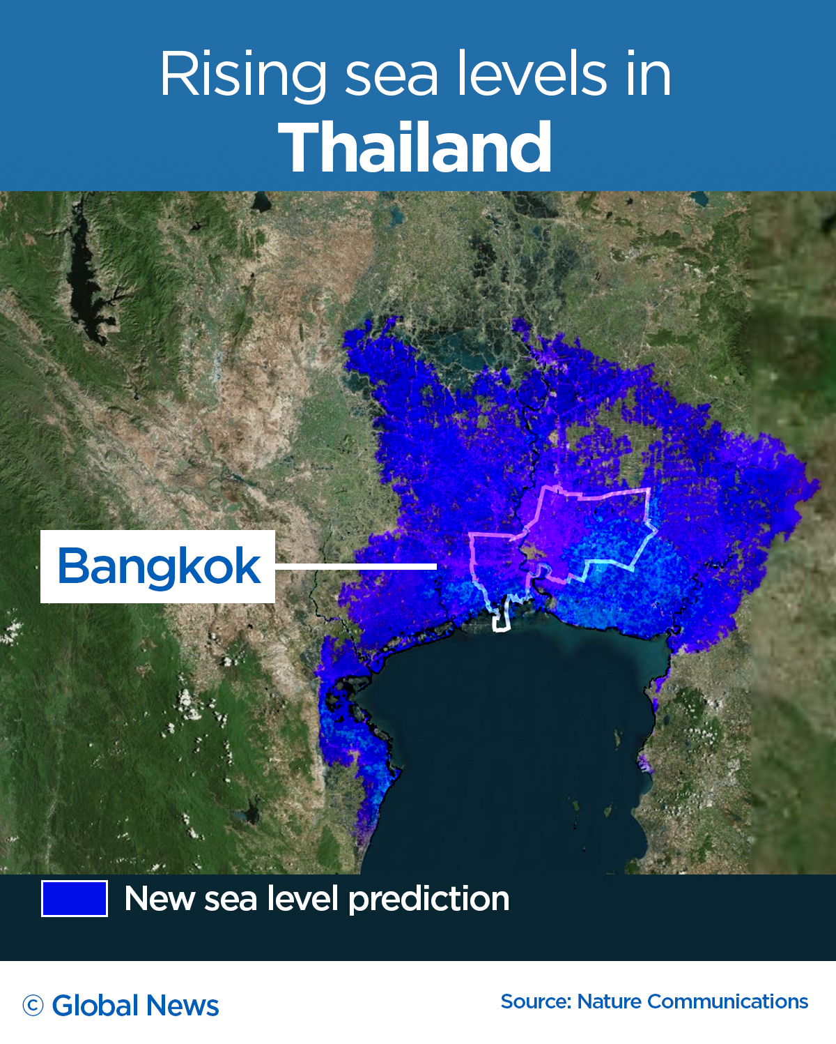
Coastal regions in East and South Asia are “by far the most threatened,” Strauss said. More than 85 per cent of people on vulnerable land live in those regions.
- Canadian man dies during Texas Ironman event. His widow wants answers as to why
- On the ‘frontline’: Toronto-area residents hiring security firms to fight auto theft
- Honda’s $15B Ontario EV plant marks ‘historic day,’ Trudeau says
- Canadians more likely to eat food past best-before date. What are the risks?
“It appears that there will be a major need for coastal defences or relocation in many mega cities across Asia, especially the ones on major river deltas,” Strauss said.
China contains the largest affected population, followed by Bangladesh, India, Vietnam, Indonesia and Thailand.
Strauss says that an estimated 110 million people were also found to be currently living in areas under the high tide line, likely protected by coastal defences already in place — such as levees and sea walls — and naturally-occurring defences as well, such as mangrove forests.
“This study indicates that there is at least some possibility of defending the very large numbers of people who are going to be threatened by rising seas this century,” he said.
“We already have evidence of that.”
The study found that rapidly reducing greenhouse gas emissions in the present could prevent worse coastal flooding by the end of this century.

What did they look at?
Strauss and co-author Scott Kulp used updated elevation data to reach their conclusions.
While most climate and sea-level scientists focus on projections of climate or sea-level change, the latest study examines the issue in a different light, according to Strauss.
“The research before us has focused on how is the elevation of the water going to change,” he said. “And we said, wait a minute. We realized that we don’t really understand what the elevation of the land is.”
Since it’s “simply not feasible” to send a new satellite into space to collect new elevation data, he and Kulp applied artificial intelligence to “try and improve the data” using whatever information they already had.
“I think the research community is welcoming this as an important new contribution to improving our understanding of what the threat really is,” Strauss said.


What does this mean for Canada?
According to Strauss, Canada “comes out very well” in the face of rising sea levels, because the country is still recovering from the effects of the last Ice Age.
“A lot of the land mass in Canada is slowly lifting,” he said. “So even as sea levels rise, that rise is not as problematic for Canada as for many other countries in the world because the land is coming close to keeping pace.”
The online map — dubbed a coastal risk screening tool — produced by Climate Central shows which parts of the world have land at risk of rising sea levels.
In Canada, land that is projected to be below annual flood levels by 2050 — i.e. vulnerable to yearly flooding — can be found in places across the country, including in places such as Richmond, in B.C., Churchill in Manitoba, Attawapiskat in Ontario, and Fredericton in New Brunswick.
The study’s worst case scenario shows that around 840,000 Canadians currently live on land that could be flooded every year by 2100, Strauss said.
In the near term, an estimated 500,000 Canadians live on land that “could face annual flooding” by 2050, he added.

What next?
This most recent analysis was done under a range of scenarios such as increased carbon emissions in the future, or more ambitious cuts to emissions than the 2015 Paris agreement.
The bright side of their study? It shows that the benefits of meeting emissions targets are “a lot bigger.”
“The silver lining through our results is that cutting climate pollution can result in a much greater benefit than we previously anticipated,” Strauss said. “Because it can avoid a much greater harm than previously understood.”
The worst case scenario, for instance, shows that nine per cent of the world’s population lives in areas that could face annual flooding by 2100.
But in a scenario in which emissions are sharply reduced, that figure “might be cut in half,” Strauss said.
“We have really concentrated our population in the lowest, most vulnerable strip along our global coasts,” he said.
“It does set us up for some great challenges in the coming decades.”
Comments