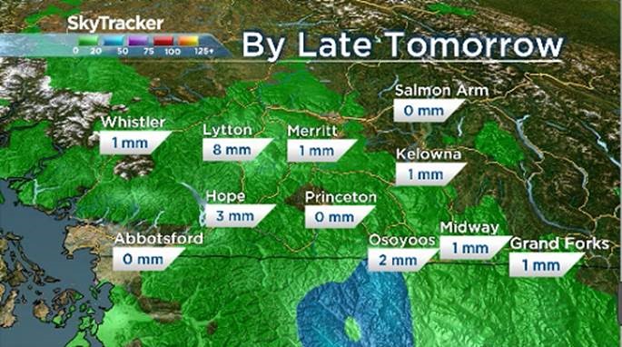
As much as 20 to 40 mm of rain was expected to fall over the last couple of days, but that didn’t happen in most regions.

There were forecasts of thunderstorms, but not as many happened as there could have been.
Coverage of floods on Globalnews.ca/bc:
The B.C. River Forecast Centre was mostly concerned about heavy rainfall, but amounts were limited to anywhere between 0 and 15 mm, though a few spots received 25 mm.
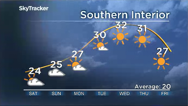
In addition, temperatures were cooler on Thursday, slowing the snow melt to more manageable rates.
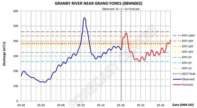
The Boundary and Kootenay regions were hit hardest and will still be affected by snowpack runoff.
Water levels are expected to peak today and tomorrow.

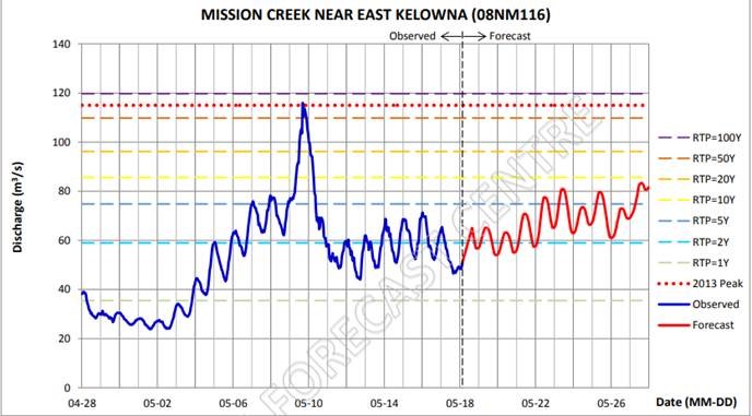
Meanwhile, in the Okanagan Valley, and the Similkameen, Shuswap and Thompson regions, the rain had no noticeable effect on the rivers.

Further downstream, peak levels are forecasted to peak on Sunday, Monday and Tuesday.

- Old Man Winter wallops B.C.’s Mainland/Southwest region, major highway closed
- Calgary hit by unexpected blast of spring snow, causing dozens of crashes
- False spring strikes again: Saskatchewan prepares for incoming winter weather
- Albertans’ interest in alternative forms of travel growing as fuel prices spike
Rainfall in the next 24 hours will be quite minimal and focused on areas further west.
This may have an impact on the Lower Fraser River.

But for the most part, the River Forecast Centre is no longer concerned about future rainfall and conditions will begin to dry out this weekend.

Get breaking National news
Temperatures are going to climb again but it will be a slow climb so snow melt will be at a manageable rate for the next couple of days.


Comments
Want to discuss? Please read our Commenting Policy first.