

WATCH ABOVE: An aggressive wildfire in North Central B.C. has prompted an evacuation order. Jeremy Hunka reports.

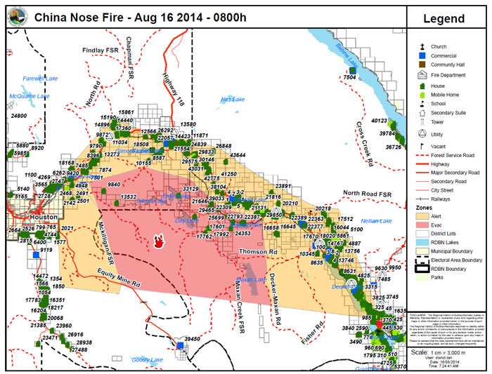
VANCOUVER – Twenty homes remain under an Evacuation Order along Highway 16 as a massive fire continues to burn largely uncontrolled about 15 km south of Houston.
The fire is estimated to be 3,700 hectares in size. It is likely to remain active over the next few days.
One hundred and thirty-five firefighters spent Friday night and Saturday battling the blaze and more personnel are en route.
670 homes are also on evacuation alert.
However, the regional district is in the process of re-evaluating evacuation orders and alerts.
A cold weather front that moved in through the night was expected to bring strong winds and hamper firefighting efforts. However, there wasn’t as much wind as was forecast overnight, resulting in minimal fire growth
Areas under Evacuation Order:
- South from 9840 Heading Creek FSR, North to Gilmore Lake FSR and Sunset FSR intersection, west to the Snow Mobile Cabin on Equity Mine Road, east to and including Crow Creek Road beyond the train tracks, east to 22387 and 22507, north including the entirety of the Rose Lake Cutoff Rd. Including Day Lake Road, southern portions of the Forest Dale Canyon Road, northern portion of the Maxan Creek FSR to the south west portion of the Decker-Maxan Rd. Including Bulkley Lake, Day Lake, Elwin Lake and Maxan Lake.
- Any person within the Evacuation Order area must leave immediately. Evacuees must register at the closest Reception Centre between 8:30 a.m. and 4:30 p.m. Reception centres are located at the College of New Caledonia Burns Lake Campus or the Houston Municipal Office. Additional information can be obtained by contacting the Regional District of Bulkley-Nechako.
MAP: Area of Evacuation Order and Alert:
Residents must leave the area immediately. Evacuees please note:
- Register at an Emergency Social Services (ESS) Centre in Burns Lake at the Burns Lake Heritage Centre (Burns Lake Chamber of Commerce) at 540 Highway 16 or contact the Emergency Social Services Director at 250-251-0064; or
- At the Emergency Social Services Centre in Houston at the Houston Municipal Office 3367 12th Street or contact the Houston Emergency Social Services Centre at 250-845-2238.
- Emergency Social Services can provide assistance for food, lodging, clothing, emotional support and family reunification.
If you need transportation assistance from the area call the Regional District of Bulkley-Nechako at 250-692-3195.
Highway 16 is now reopened to traffic from four kilometers east of Topley to 18 kilometers west of Burns Lake but may close again on short notice due to fire activity.
Before you leave your house, residents are being asked to close all windows and doors, hut off all gas and electrical appliances, other than refrigerators and freezers and close gates (latch) but do not lock.
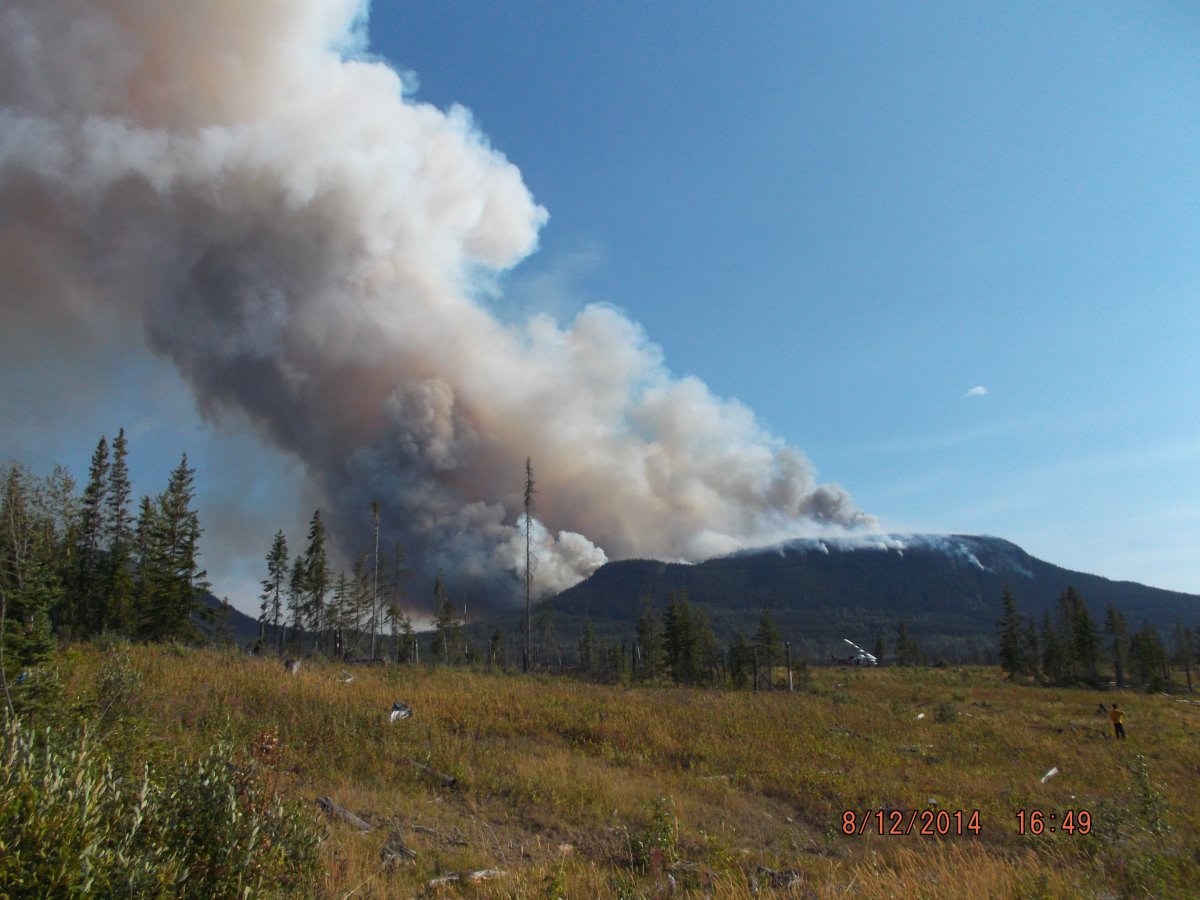
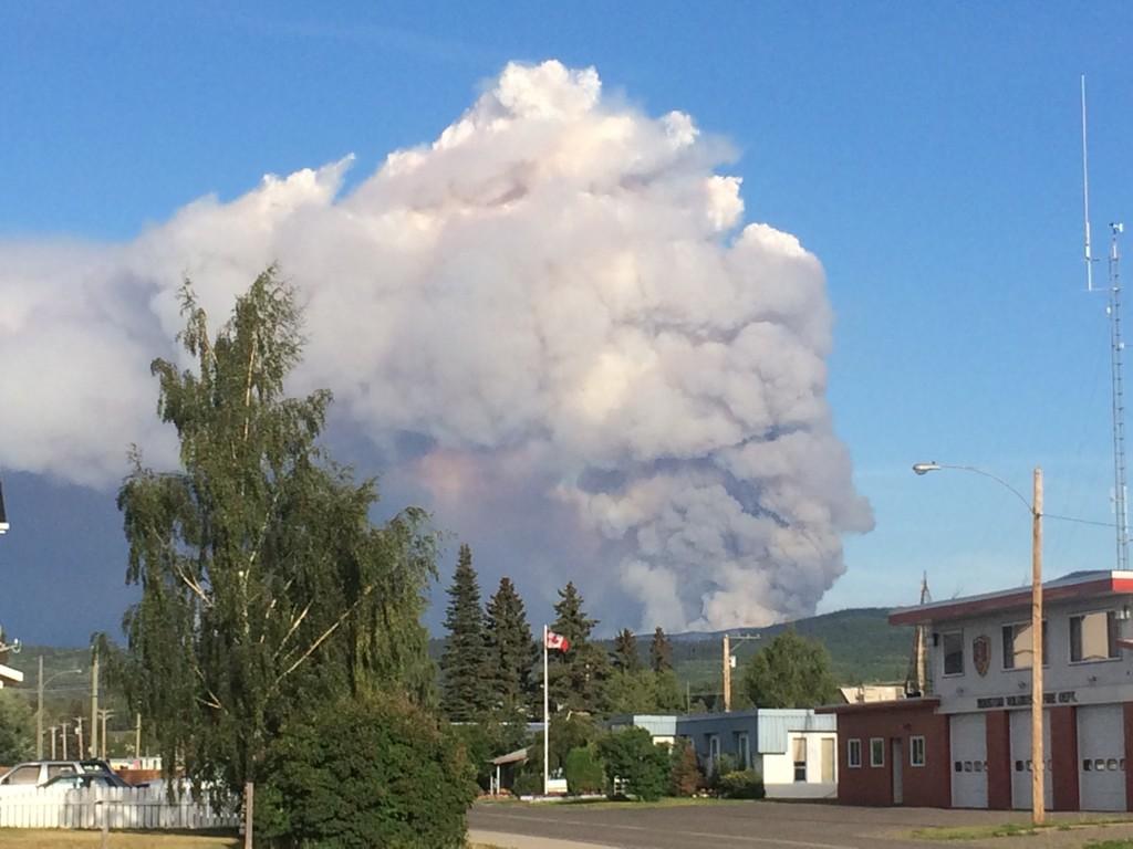
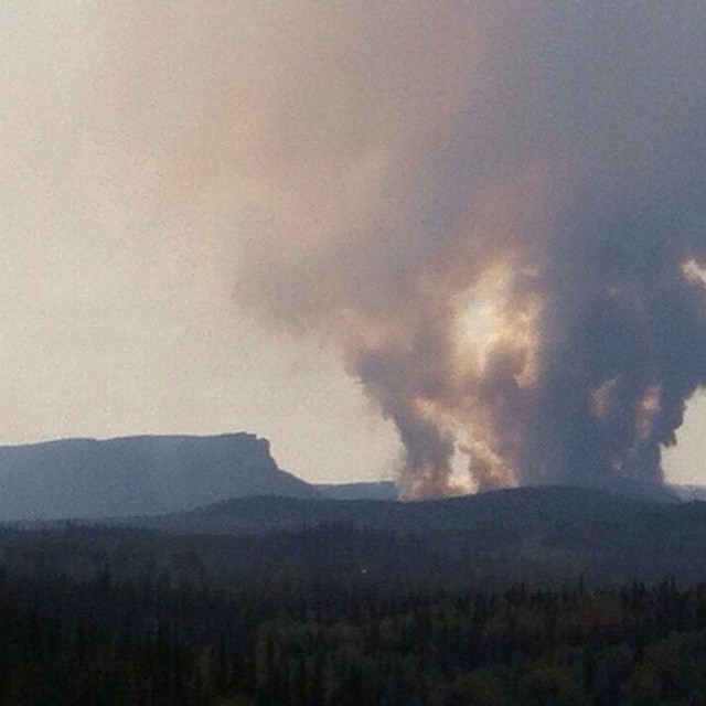
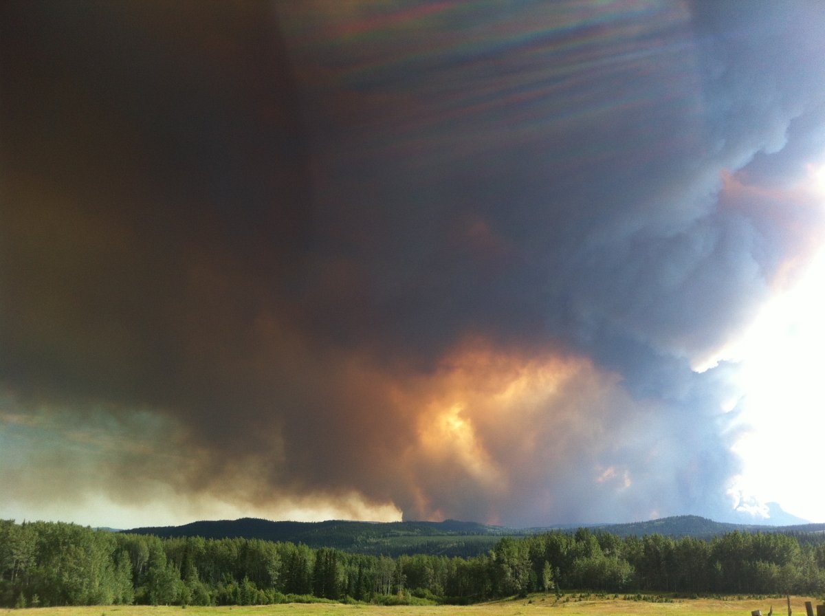
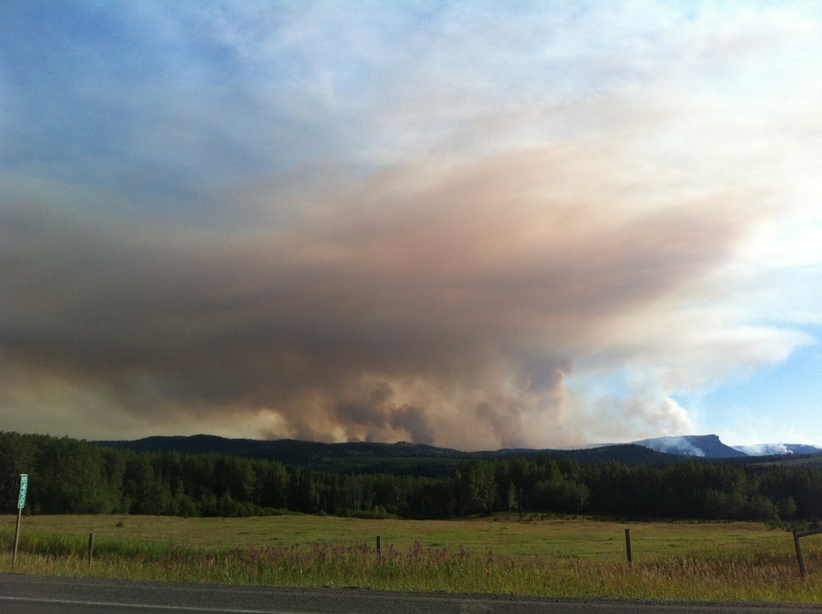
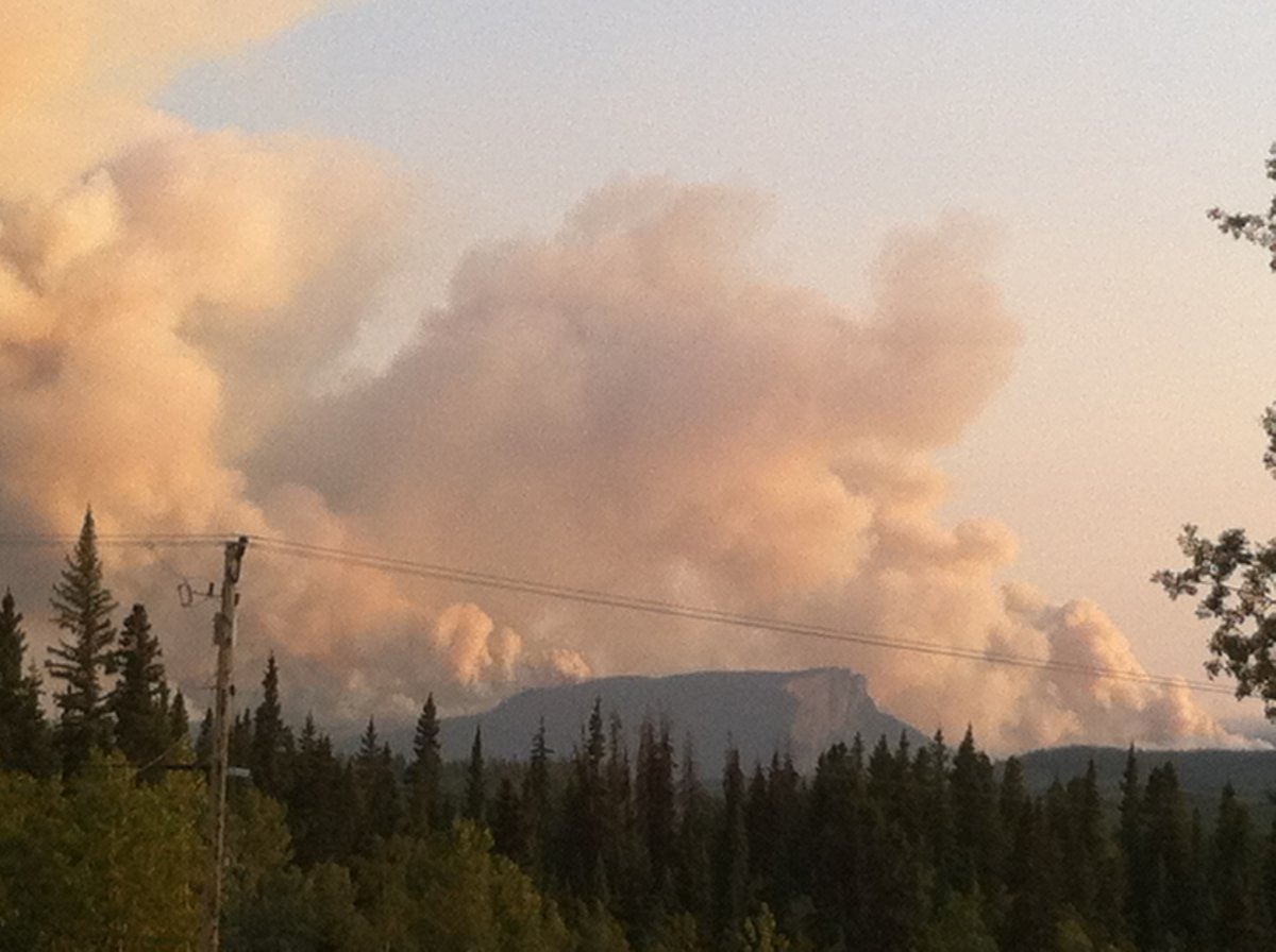
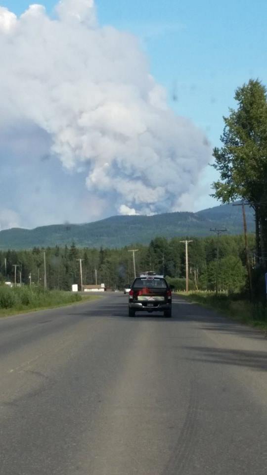
GALLERY:


Areas under Evacuation Alert:
- From the municipal boundary of the District of Houston from 4728 Bellicini Rd and 4411 McKilligan Rd. east along the Highway 16 corridor to the western Boundary of the Village of Burns Lake at 1740 Nash Rd. including Murphy Road and Miller Road. Including the communities of Topley, Rose Lake, Palling and Decker Lake. All roads connected to Highway 16. and including portions of Thomson Rd, Decker-Maxan Rd. and Fisher Rd. See the attached map for details.
- An Evacuation Alert has been issued to prepare you to evacuate your premises or property and/or livestock should it be found necessary. Residents within the Evacuation Alert area need to be prepared to leave the area should conditions warrant an escalation to an Evacuation Order again.
- The Knockholt Landfill remains closed and will be re-evaluated daily.
A notice to residents in Burns Lake. Decker Lake is not under an Evacuation Order. It is presently under an Evacuation Alert.
A campfire and open burning prohibition is in effect in the Nadina Fire Zone, the Bulkley Fire Zone and the Skeena Fire Zone (with the exception of the former North Coast District).
The Wildfire Management Branch has also placed an area restriction order for areas around the fire.
This Order applies to the McKilligan, Swan Lake, Heading Creek, Poisent Creek, Gilmore Lake forest service roads and portions of the Thompson Creek Forest Service Road immediately north of Maxan Lake.
People wishing to access the area must first receive written authorization from an official. Residents not under evacuation order may also travel to and from their residence.
Comments