

California continues to feel the wrath of a series of storms that have dumped massive amounts of rain in the state to start the year.

Many Californians woke up Tuesday to no reprieve from the extreme weather, which has forced thousands to evacuate their homes.
Tuesday’s storm prompted a few tornado warnings early in the morning. It was also expected to bring heavy snow to California’s Sierra Nevada, a day after dumping almost 14 inches (36 centimetres) of rain at higher elevations in central and Southern California.
How has the weather impacted California? Here’s a look at the storm’s damage so far.
When did the storms begin?
California has been dealing with severe weather since Dec. 31, when a powerful storm brought heavy rain and snowfall to much of the state.
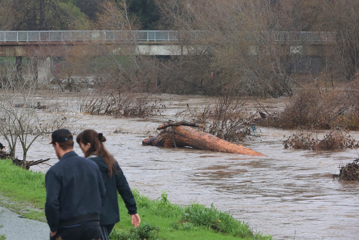
Major flooding occurred in agricultural areas about 32 kilometres south of Sacramento on Jan. 1, where rivers swelled beyond their banks and inundated dozens of cars along State Route 99.
It was the first of several storms that were expected to roll across California. On Jan. 4, powerful winds roared into California, toppling trees as crews rushed to clear storm drains from earlier storms, and as people fortified their homes in preparation for flooding and power outages.
The extreme weather continued on Jan. 5, and as the weekend arrived, rain started to sweep into the northern part of the state and the San Francisco Bay area on Saturday, preceding a series of powerful Pacific storms that were set to hit starting Monday.
At least 14 people have died from the storms as of Tuesday, officials said.
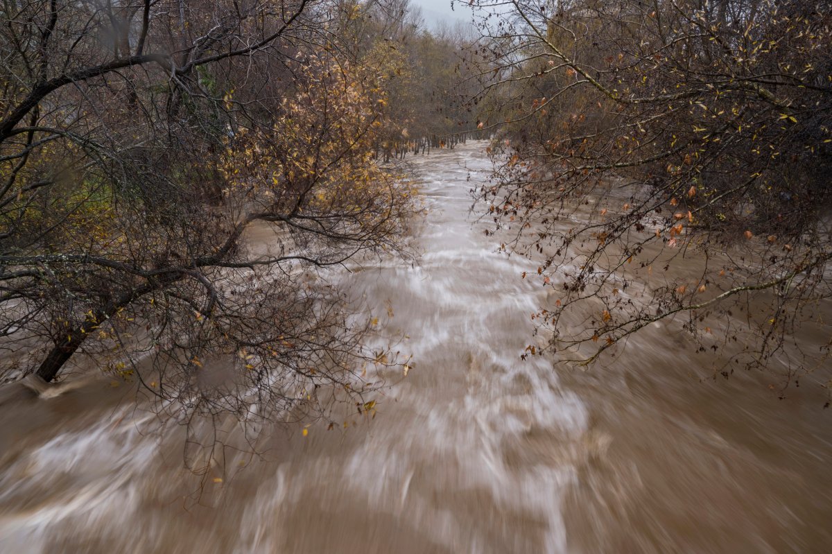
The National Weather Service has warned of a “relentless parade of atmospheric rivers” for California — long plumes of moisture stretching out into the Pacific that can drop large amounts of rain and snow.
What’s happening now?
U.S. President Joe Biden issued an emergency declaration on Monday to support storm response and relief efforts in more than a dozen California counties.
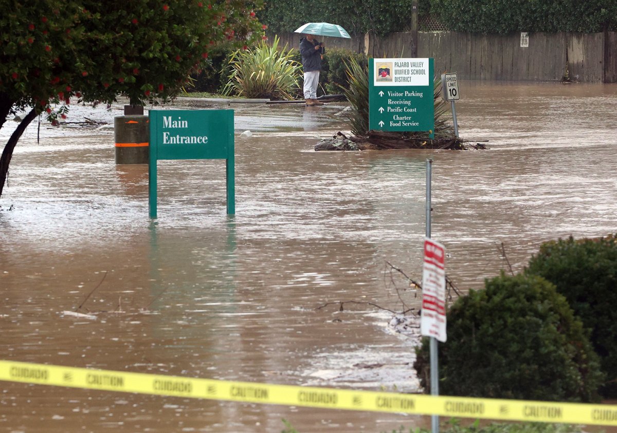
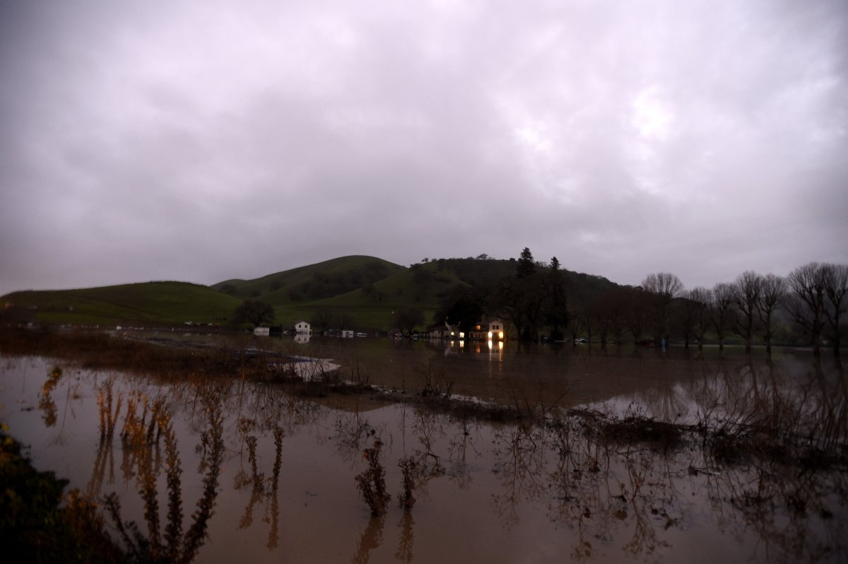
Rainfall on Tuesday continued to swamp roads and batter coastlines with high surf, turning rivers into flood zones and forcing thousands living in towns with histories of deadly mudslides to evacuate.
More than 200,000 homes and businesses were without power early Tuesday, according to the website poweroutage.us, which tracks utility reports. A flood watch for the entire San Francisco Bay Area, along with Sacramento Valley and Monterey Bay, was issued.
Several parts of U.S. and state highways were closed because of flooding, mud or rockslides, heavy snow or car spinouts and truck crashes, California state highway authorities said Monday night.

Evacuation orders were issued in Santa Cruz County for about 32,000 residents living near rain-swollen rivers and creeks. Drone footage showed numerous homes sitting in muddy brown water.
A five-year-old boy vanished in floodwaters Monday on California’s central coast. The boy’s mother was driving a truck when it became stranded near Paso Robles. Bystanders managed to pull her free, but the boy was swept out of the truck and carried away, probably into a river, an official said.


A roughly seven-hour search for the missing boy turned up only his shoe before officials called it off with water levels too dangerous for divers, officials said. The boy had not been declared dead, said San Luis Obispo County Sheriff’s Office Spokesperson Tony Cipolla.
About 10,000 people have been ordered to evacuate in Santa Barbara County, as well as the entire seaside community of Montecito — home to Prince Harry, Oprah Winfrey and other celebrities.

La Conchita, a coastal town in Ventura County, was also ordered evacuated. In the country, the Ventura River reached its highest level on record at more than 25 feet on Monday. Firefighters using helicopters rescued more than a dozen people trapped on an island in the surging waters. The water level quickly dropped to minor flood-stage levels overnight.
In Los Angeles, a sinkhole swallowed two cars near Chatsworth on Monday night. Two people escaped by themselves and firefighters rescued two others who had minor injuries, officials said.
What’s forecasted for California in the coming days?
Numerous parts of California were under National Weather Service alerts on Tuesday, with some extending into Wednesday as well.
Santa Barbara County’s southern coast was subject to a high surf advisory, with the agency warning of surfs of up to eight feet possible overnight and into Wednesday.

In the Coachella Valley, 105 km/h winds were expected throughout Tuesday, the weather service said in its wind advisory for the region.
In Los Angeles and surrounding areas, a flood watch was expected to remain in effect until 10 p.m. local time Wednesday. A strong Pacific storm system was expected to bring periods of widespread heavy rainfall with rates between one-half and one inch per hour, it said.

For Canadians in storm areas, Global Affairs Canada advises them to move to higher ground, exercise caution, stay informed and follow the instructions of local authorities, including evacuation orders.
Atmospheric rivers, named by researchers in the 1990s, occur globally but are especially significant on the U.S. West Coast, where they create 30 per cent to 50 per cent of annual precipitation, according to the National Oceanic and Atmospheric Administration.
— with files from The Associated Press
Comments