
A Cold Front went through Sunday and in it’s wake MUCH Cooler, Drier Arctic Air has descended down across BC & Alberta.

That drier air mass helped clear out our stubborn low overcast and fog, but it has also cooled things down.
The temperature inversion that helped keep us on cloud “lockdown” is no longer in place so expect cooler temperatures as you climb up through any of the mountain passes.
Pennask & Elkhart Summits received snow yesterday, so we are back to winter driving conditions in the mountains; be prepared.
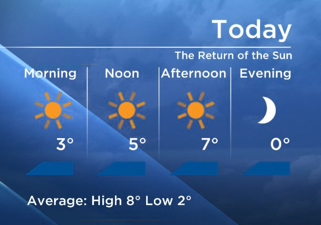
 Expect sunny and seasonally cool conditions early this week.


A nice Frontal system is getting organised offshore in the Pacific and that will affect the Southern Interior Wednesday with more cloud and the slight risk of an evening shower.
Although unsettled around Hallow e’en…Right now it looks dry Thursday evening for the Okanagan Trick or Treaters.
- Trudeau says ‘good luck’ to Saskatchewan premier in carbon price spat
- Canadians more likely to eat food past best-before date. What are the risks?
- Hundreds mourn 16-year-old Halifax homicide victim: ‘The youth are feeling it’
- Vacation death: Cuba apologizes after Canadian family receives wrong remains
Comments