
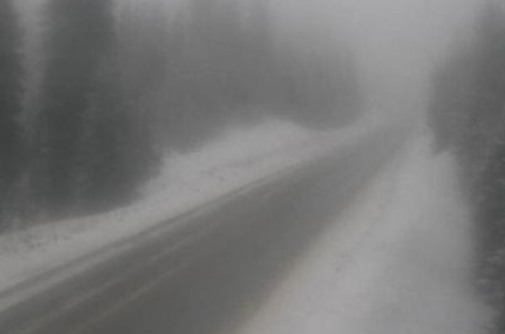
A winter storm warning has been issued for the portion of Highway 3 between Paulson Summit and Kootenay Pass.

Anywhere from 25 to 35 centimetres of snow is expected to fall before Tuesday night, with heavy snow expected from Monday afternoon to Tuesday morning. Approximately 15 centimetres of snow will accumulate by Tuesday morning.
“The atmosphere becomes unstable Tuesday afternoon when convective heavy flurries are expected,” Environment Canada said in a press release.
The national weather agency explained that convective flurries are periods of intense snow and during these times, there’s more uncertainty in the snowfall accumulations. Therefore, an additional 10 to 20 centimetres of snow is possible by Tuesday night, the agency said.


The snow levels during this period are 1,000 to 1,200 metres. Snow will fall above the snow levels and rain showers are expected to fall at lower elevations.
All of this means road conditions may be challenging to motorists should be careful.
- Budget 2024 failed to spark ‘political reboot’ for Liberals, polling suggests
- Train goes up in flames while rolling through London, Ont. Here’s what we know
- Peel police chief met Sri Lankan officer a court says ‘participated’ in torture
- Wrong remains sent to ‘exhausted’ Canadian family after death on Cuba vacation
Comments