
Clearing skies return across the Okanagan on Monday with temperatures making their way up to 4 C in the afternoon.

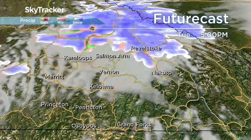
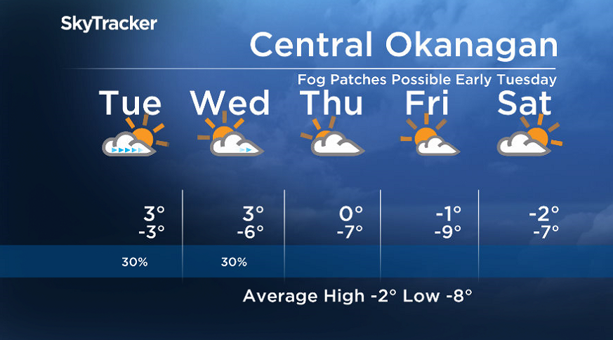
Tuesday arrives with a sunny start before another wave of clouds rolls into the region as the mercury starts off the day around -4 C and then we remove the minus sign for the daytime high.
Wednesday’s daytime high should crack the freezing mark by a few degrees once again under clearing skies with a slight chance of precipitation before partly-to-mostly cloudy skies linger through the rest of the week.
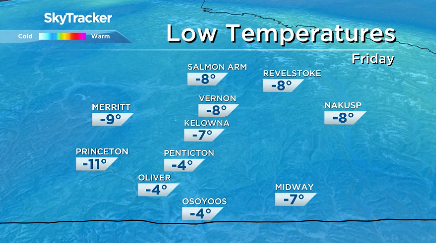
The big change will be arctic air that’s charging toward the region, dropping afternoon highs to the freezing mark Friday and below freezing Friday night and into the weekend.


The second to last weekend of January will stay cool with highs below freezing under a mix of sun and cloud.
For weather on the go download the Global News SkyTracker Weather App for iPhone, iPad or Android.
- Trudeau tight-lipped on potential U.S. TikTok ban as key bill passes
- Canadian man dies during Texas Ironman event. His widow wants answers as to why
- Hundreds mourn 16-year-old Halifax homicide victim: ‘The youth are feeling it’
- On the ‘frontline’: Toronto-area residents hiring security firms to fight auto theft
Comments