
Cold Arctic air got carved out of the Okanagan over the weekend, making way for a warm-up with some precipitation for the week ahead.

Misty conditions kicked off the week Monday morning with temperatures around -2 degrees with a few flurries in some areas with clouds lingering across the region into the remainder of the day.
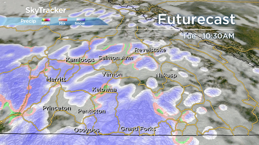
After making it up above freezing Monday afternoon, the mercury dips back below zero by a few degrees into Tuesday morning as clouds and snow slide back in to start the day.
Only a few centimetres is expected with this pulse before precipitation switches to a rain-snow mix and just plain showers in some areas with conditions warming a few degrees above freezing later in the day.
Sunny breaks are possible early Wednesday, before clouds clamber back in with a chance of flurries by evening that will linger into early Thursday with snow and rain possible during the day.


From Wednesday onward, daytime highs will hover in the 3 to 4 degree range with pockets of mixed precipitation possible right into the weekend.

For weather on the go download the Global News SkyTracker Weather App for iPhone, iPad or Android.
Comments